Saturday, January 19, 2013

My Top 5 Best CLimbs for 2012

I am just thankful..

for the wonderful hiking destinations I've been to..

for having the strength, provisions and perfect time to visit beautiful mountains in the Philippines..


for surviving the rainy treks and for enjoying those blessed sunny day of hiking..


for the quick views of soaring birds, flora and fauna and other wild creations..


for the safe, purposeful and fruitful trek..


to those who became my friends and companions in the heights.. Thank you!


Among the 17 climb events that I joined with for 2012, here are those that I love the most and which I find memorable:

1. THE HOLY MOUNTAIN - January 2012
2. MT. SICAPOO (Ilocos Norte)- February 2012
3. MT. APO (Davao) - August 2012
4. DULANG-DULANG KITANGLAD TRAVERSE (Bukidnon) - August 2012
5. MT. GUITING - GUITING (Romblon) -November 2012


Read More »

If You are Climbing for the First Time

New year. New plans. New trips. For a typical outdoor man and climbing enthusiast, it's another year of journey, more target mountain summits to reach. Yet I believe some people out there would love to try an adventure for the first time and one or more hiking destinations are on their bucket lists. And they would love this 2013 either a year of outdoors and adventure or this could be the start of something exciting they could ever experience ---  a year of getting out of the shell.

Although the title is especially dedicated to the newbies, whether you are a newbie or an all-time weekend/weekday climber, this post is for both of you. This could either be a checklist for your first, second or third climb or just simple reminders/reference in your usual climbs.

In my more than 2 years in mountaineering, I am not yet a veteran. However I could instead share simple and practical lessons i learned from various climb events I joined with.

I can still remember my first time to join a climb together with mountaineers, that was in Mt. Batulao where there is no water source at the camp site, I did not bring plenty of water that I could not even contribute to the group for cooking our food. Another thing during the same climb was when I brought a lot of shirts and a thick towel which turned out to be really unnecessary making a real bulk on my bag. Imagine how bulky it was when I didn't even have the real mountaineering gears like cook set, tent, etc. There was also a time when I brought a lot of trail water and cooking water yet there's actually a water source in Mt. Pulag near campsite(it's because I kinda learned a lesson from such mentioned first Batulao climb).  Another instance was when I wasn't able to do a proper waterproofing making my clothes and other things almost wet, that was really a rainy trek in Benguet. It added more cold feeling wearing a slightly wet jacket. Thankful I was able to sustain it.

Also, there was a little regret in me even when I started doing a hiking activity. That was a daytrip in Mt. Pinatubo and since it's my first time and so ignorant, I bought stuff that I could not even able to benefit from when I finally became a mountaineer. I should have bought quality gears so that they could have been useful up to now. I didnt ask, I didnt made a research. Anyway, when I did my first "serious and official " climb in Batulao, I knew for sure that succeeding hikes could follow that's why i really bought a good pair of hiking shoes.

Above-mentioned are only few of not-so-good instances that I would not want to be experienced by a first time climber like you. Therefore, I listed down some tips for you as your reference on the preparations.

BEFORE THE CLIMB:

1. Know what you are climbing. Is it a major or minor climb?
2. Assess yourself if you are fit with the target mountain. Do some trainings like run or climb and other warm ups, if necessary.
3. Be mindful of the requirements: both physical and financial requirements of the organizer
4. Attend the pre-climb meeting
5. At least read the itinerary of the climb so you can manage your expectations.
6. If participants are divided into meal groups, coordinate with your group mates for the meal plan. If meals are inclusions to the climb package, you dont have to worry about the food esp in the campsite.


repacking at Mt. Dulang-dulang's jump off point in Lantapan, Bukidnon, photo courtesy of Jenny Tanedo


For your physical preparation:
1. Pack light. Bring only the necessary stuff. There are ways to lessen and lighten up your backpack. (Eventually you'll learn to only buy portable and thin stuff like that of a towel lite instead of a regular thick towel. There's also the so-called compression bag which truly a great help to a more spacious backpacking, I normally use it in my 3 or 4-day climb, imagine that long climb and I only use The North Face daypack)

2. Be mindful of the proper waterproofing. This is to avoid getting your things wet in case of rain or river trekking.

3. Check your stuff if you have the following in the list:

>jacket
>shawl / bonnet 
>sleeping bag or thick blanket
>sets of clothes (if climbing overnight or more than 2 days; if it's a dayhike climb, just bring extra clothes)
>cap / bush hat
>toiletries (e.g. soap, shampoo, wet wipes, dry tissue)
>eating utensils
>canned goods (emergency food)
>headlamp or flashlight (with extra battery)
>trail food -  (jelly ace, biscuits, chips, dried fruits, etc.)
>trail water/bottled water 
>arm warmer
>extra pairs of socks
>gloves
>camera 
>raincoat or poncho / umbrella
>tent
>med kit
>powerbank

The typical convenient/comfy get up for the climb:

>tshirt with arm warmer/long sleeves
>shorts with leggings or trekking pants
>trekking shoes or trekking sandals with socks
>Cap or bonnet


The first must-haves must be the climbing gears. As included above, below must be at the top of your list since they will provide you protection and convenience:

1. Trekking shoes or sandals
2. Backpack
2. Cap/bonnet
3. Jacket


You should ask yourself if you are going to engage into frequent hikes. I understand you cannot decide for it right away, not until your first or second climb. You can only assess if you will join again after your experience in your first ever or second climb. So I suggest you only buy things which you think you can use in your trips other than hiking (that's if  you decide not to climb too often). For example, if you have other way to just borrow gears, you may do so. But if you decide to buy one, just buy quality gears most especially trekking shoes and backpacks as they may be so beneficial for a significant time and for your convenient and safe climb.

Knowing why you climb affects the way you spend for this extreme hobby. Just remember that you only buy those of good quality that can last for a long time. There are lots of both local and foreign products, that are still friendly to the pockets. My personal choice is Salomon for trekking shoes and The North Face and Deuter for backpacks. All other gears, I usually buy from Conquer, a local outdoor shop. If you are not too choosy and you are patient enough, you can get a good score on hand-me down branded mountaineering products from online and ukay-ukay.

When you have finally decided that you love mountaineering to the point that you are targeting more mountains or you even have deeper reasons for climbing and you are convinced enough that you will really make it as your regular hobby, that's the only time you buy camping gears like tent, portable stove, cookset, knife and lamp. Further to these are already add-on gears like GPS, altimeter, etc. You should know your priorities. 

They say mountaineering is an expensive hobby. I both say yes and no. Yes, the gears are expensive. You will really fall into the side of absolute Yes if you do not know how to spend and buy wisely. Investing in mountaineering gears is rooted and depends on your passion. It will somehow never be a big burden  to your pocket if you know why you climb. Besides, it is never buying on a bulk basis. It takes time to save up and collect the necessay items you need. Normally, one can gradually learn in every actual climb which gears are perfect for you. Don't be in a hurry. You can have it all with proper budget and research. Think first before buying. You just have to answer two things: 1. Is it worth and quality enough to save up for it? 2. Do I really need it?

Few, portable, necessary and good. That's it! Come to think of it, it will even support to a pack light strategy :)

THE CLIMB PROPER

1. Enjoy the trail. Catch more photos of the scenic views -- mountainous views, cliff, plants, flora and fauna, different species and the like. 
2. Have a good interval of trek and rest. You may have enough time to have a break and rest.
3. Enjoy the company of the mountaineers or the group. Laugh and joke a lot. Establish and initiate a good conversation. Enjoy the social time during the camping.
4. Feel the camping on its most inconvenience yet fun experience. 
5. Be watchful especially on the trail you are stepping to. Focus and have extra care trekking. Don't let yourself become miles away from your companions and guide.
5. Have an adventurous spirit. Be determined that you'll make it to the summit, finish the climb, survive the trekking and the camping. Just imagine if it rained? What would you do? Would you cry and get annoyed on the wet and muddy trek or would you feel the rain and aim to survive?
6. Live the LEAVE NO TRACE rule. Be responsible to the nature. Dispose your garbage properly and don't pick anything, like plants or flowers, from the mountain.


Mt. Gulugod Baboy Summit, photo taken by Leween Agriflor


FINAL REMINDERS

Upon your descent and respective "home sweet home", carry on with your experience -- sort of adventurous and inconvenient trip yet indeed fun. Only few people dare to risk and tire themselves with these activities and only few have witnessed personally the beauty of nature. Be proud, you are one of them.

You should also remember that not because you do a lot of hiking, you are already considered a mountaineer.  Individuals have different reasons why they climb. Perhaps some do it to socialize, some do it to just visit and witness some do it for noble reasons, others just pass by to experience what it feels like to do hike and camp. Having identified the reasons why you do it, in one way or another, it has an impact on both the mountain and yourself. So whatever reasons you have in your mind, you do the climb with passion, great respect and responsibility.
Read More »

Sunday, December 9, 2012

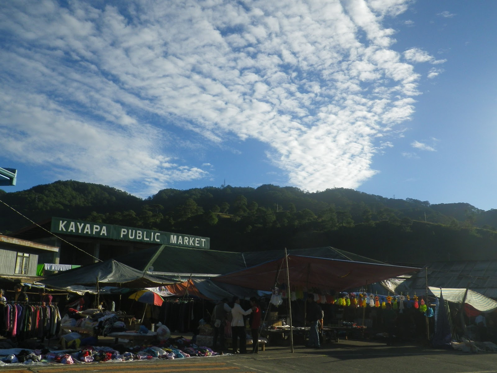
Mt. Ugo Traverse (Kayapa - Itogon) Nov17-18,2012


Location: Itogon, Benguet
Entry to Exit Point: Kayapa, Nueva Vizcaya to Itogon, Benguet
2,150 Meters Above Sea Level
Difficulty: Major Climb, 5/9 (per pinoymountaineer.com)


Initially, my motive to climb Mt. Ugo was to do an outreach but I wasn’t able to join my group last year.. Organizing an outreach climb isn’t easy so I decided to first observe the place (Domolpos Village). Perhaps in the future, my climb buddy and I might be able to finally organize one. Hopefully!

Our visit to Mt. Ugo was a two-day traverse (overnight weekend climb). The mountain is a popular climbing destination in the Cordillera region along with Mt. Pulag, Mt. Ugo and Mt. Napulauan. I was happy that this 2012, I was able to complete these great traverses in the Cordilleras (We went hiking Amuyao in June and then Napulauan in August).

We were just blessed to have a very fine weather.  We’re  a total of 18 climbers including my sister Maybelle. This climb was her fourth but her first ever traverse, that’s why doing a long trek really surprised her.


The event was simple yet still memorable.  Perfect weather, good companions, laughters, wonderful views, food, friendships. 

Started at 9am and lunch break at Indupit Village. The trail was really ascending until the Indupit Village where after eating lunch and then resumed, we trekked plainly and steadily at plateaus.  Such gradual trek lasted only upon approaching summit where succeeding assault trail follows.  Along our trekking, I finally saw the school at Domolpos Village.  Perhaps,  such school of the village is fortunate enough that they are recipients of outdoormen’s generosity and initiative to help. The school as I view from afar looks fine and newly painted. (On the other hand, I knew I could have gone down there and assess further, perhaps the school there needs more). 

my sister Maybelle in the middle of the  trek

chillax at the plateau

To continue, as we trek up summit of Mt. Ugo, it started to get foggy. We reached the campsite ( a few meters away from summit)  at 5:30pm. It also started to get colder. The cold temperature there as compared to the other Cordillera mountains I mentioned above is much more tolerable. Maybe, we were just given a fine weather, no strong winds, no rains.

Sunrise viewing the following morning, The only mountain I’ve identified there at the campsite was Mt. Pulag.

sunrise by Buddy Dennis Hisanan


After eating breakfast, we did respective "breakcamp" and started the traverse.. after a very few steps was already summit. 

a few steps to summit
at 2,150 MASL
I now understand why it’s better not to camp there although there’s a lot of space. It’s because cows are scattered and possible attack may happen. A very steep descent and then we reached the pine forests. As we trek, a clear view of Mt. Sto. Tomas and Baguio City can be seen on the left. That sunny day was really sunny and really made my skin even darker. The trek at pine forests, although it’s only steady hiking,  was still tiring because of somewhat long trek to Itogon (the exit point) under extreme heat of the sun. Most of us were already running on the trail.


view of Mt. Sto. Tomas and Baguio City
Pine trees everywhere during our descent


Nearing exit point, was little assault trails and steep descents. Finally, we reached the long hanging steel bridge marking the end of the trek. We got our certificate and did our wash-ups at the barangay office. It was around 6pm when we left for Baguio City.


Read More »

Saturday, December 1, 2012

Mt. Guiting-Guiting Traverse

Location: Sibuyan Island, Romblon
Entry to Exit Point: Olango, San Fernando to Tampayan, Magdiwang
2,058 Meters Above Sea Level
Difficulty: Major Climb, 9/9 

Nov 2-3, 2012

“Its unique features equate a different level of difficulty, yet one could witness breathtaking and spectacular views at the top and throughout the trek. Completing the traverse is indeed very rewarding.”

There's a perfect time for everything! Finally I had my fair share of Mt. Guiting-Guiting climb experience. Originally set April of this year but it was cancelled and so I set myself to target it again in June, which of course, is already rainy season and therefore it didn't materialize. I felt the urge though of still climbing it even if circumstances seemed not to allow me yet to go there. Came a time that I stopped planning to climb it but i'm too curious of what it feels like to conquer a mountain which they say is seriously tough. Actually, when my climb buddy, Dennis, climbed it for the first time in December last year, I requested him to pick up a stone for me so that I could have a reason to return it this 2012 (hey, we broke the Leave No trace Rule) I held on to that promise. (Side story: Buddy Dennis Hisanan, in his first time to climb G2 made it to finish the traverse in about 19-hour dayhike. Yes, a dayhike! ^_^ ).

So I set again a plan C setting the climb on the long weekend of November. Know what? I was  hesitating but still said Yes. Unsure. Admittedly, I was climbing with an incomplete excitement, not so mentally prepared, unsure and with pressure. Never knew something very beautiful memories and experiences awaited me upon climbing this mountain.

Mt. Guiting-guiting, in my opinion, is a dream mountain for every Filipino climbing enthusiast because of its intimidating difficulty that one could take pride upon every succesful conquest. Popularly  known as "G2" by the mountaineers
, it is considered as one of the most difficult and technically challenging mountains in the Philippines. Located in the heart of Sibuyan Island, Romblon, the traverse we successfully made was via San Fernando to Magdiwang. As of this blog, there are only two routes that can be done in climbing this mountain: first is the traditional trail in Sitio Tampayan, Magdiwang (backtrail) and the second one is the traverse, an entry point in Sitio Olango, Brgy. Espana, San Fernando exiting Magdiwang. The traverse was opened only in 2009 according to the guide, Tatay Remy Robiso, a popular guide of the traverse and one of those who pioneered the Olango trail. According to him, it was such a great accomplishment then for him when he was still a park ranger and working for DENR. In his opinion, the difficulty of this traverse is 10/9 since the traditional climb is already rated 9/9.

Targeting G2 will not only require strength in climbing it, but also patience in hassle rides. You need to find enjoyment in long sailing thru ferry. And so a very  long trip was faced by us in the quest of reaching the Sibuyan Island.


It was Wednesday then and the ship route to Romblon was only up to Odiongan (Tablas Island). We traveled to Batangas Port in the afternoon and it was almost 7pm when the ferry left the port). It was an irritating ride. We bought the Fiesta Class ticket (non-aircon) and I just have to say this without mentioning the name of the ferry—bed bugs are rampant. I could not sleep well. I even got my arms swollen because of the bites. I just thought we should have instead taken the aircon room even though it would cost us more bucks, at least it could have been a comfortable ride.


From Odiongan Port, we took two-hour  jeepney ride to San Agustin Port but unfortunately there was no trip that would directly transport us to Sibuyan. So we had to ride a motorboat but we had to alight first at Romblon Port and then ride another boat to Sibuyan. It was really a hassle but it’s part of the adventure! We arrived lunchtime at Ambulong Port in Magdiwang, Sibuyan Island and then proceeded to a pre-arranged tricycle ride to San Fernando. It was a rough road trip overlooking the seashore on the side. To add more hassle to what we’ve been through, we got one of the tires flat. So as Kuya driver replaces it, we were given a time to take some pictures on the seashore.

In a hurry to ride a boat at Romblon Port

unplanned stop over and picture taking (on our way to Sitio Olango)

We arrived at Tatay Remy’s house in Sitio Olango, Brgy Espana in San Fernando and then later had a meet-up and asked for the blessing of the town’s Mayor (actually we have been warned of the mountain’s difficulty). We spent the night at Tatay Remy’s house.


view of Mt. Guiting-Guiting from the town of San Fernando

ONE-DAY-UP TO SUMMIT (Olango Side)

At 2am the following day we're already up and prepared everything. We started the trek at 3:30am. Since we should arrive at the summit before nightfall and  we should reach each point at a designated time, we had to increase our pacing as much as possible. In a 30-minute steady hiking, we reached the Olango river. This is the first water source. We refilled our water bottles and containers. The next would only be at Camp 3 which we would probably hit before lunch


Just before leaving Camp 1

a very steep assault

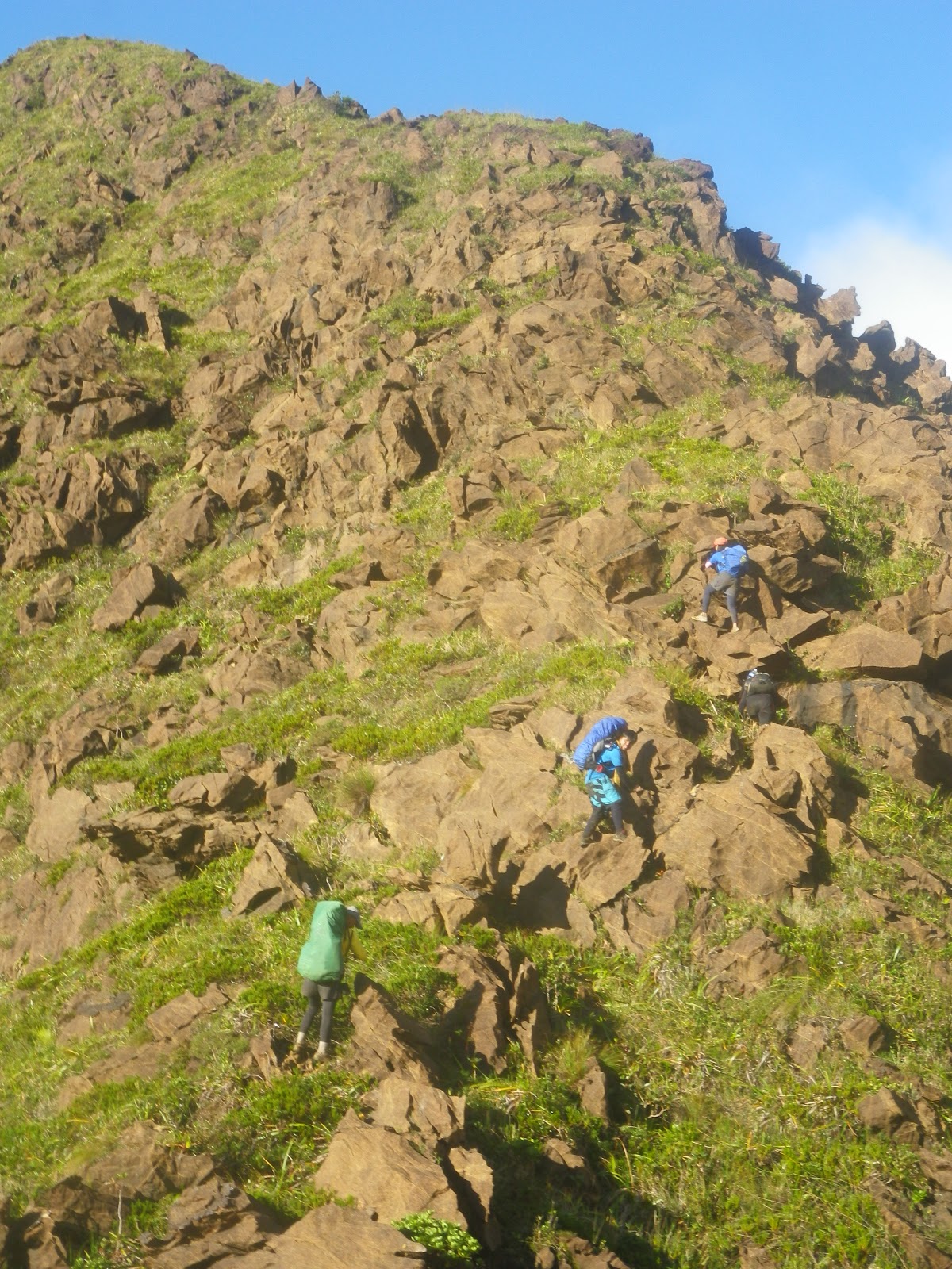
As we continue the trek, succeeding assault trails followed. It felt like it's a continuous cardiac trail of Mt. Makiling. We reached Camp 1 after more than an hour. Surprisingly, the next trail was literally rocks, both cliffs at each side . Truly, buddy Dennis is right when he told me that everything about the trail is rock. It' a very long steep climb, multiple times as Melkas ridge of Mt. Makiling. Just like what the guide says, anyone who does the traverse should have strong arms. Each step is literally a climb and one would require to exert his/her great effort in order to sustain the trail. To think, we just took the new trail called Team Outdoor Pilipinas and it's already tough. According to Tatay Remy, the old trail is harder-- a side trail directly facing the cliff. Throughout the trek, we encountered a number of beautiful flora and fauna and big pitcher plants. Some of them are same size as my shoes. On the other hand, buddy Dennis was not feeling well then. From time to time he threw up and he looked fainted. He was wondering, considering he already traversed the mountain through a dayhike last year and he was behaving like that. Probably it was because of  lack of sleep and he didn't eat before we get started. Tatay Remy was also already asking him if he could sustain the climb but he pushed through and he made it until Camp 3 where we ate our lunch and thankfully he has recharged himself. He’s back to life!


wonderful flora in the wild

pitcher plant

From such point, we were already behind our itinerary yet still within the maximum time we can stay there. Delayed though, the target was, we should be leaving Camp 3 by 1pm and favorably, at 12:45pm we were able to resume. From that point, we could completely view the rocky structure of the peaks of Mt. Guiting-Guiting. Extra care must be the first concern as when you look around, cliffs seem to scare you. The next target after Camp 3 was to reach the Crash site by 3pm. An open trail followed. There was an area there that I would not forget--- a side trek with a first glimpse of "kiss the wall" followed by a high assault by stepping into separate knife edge - shaped rock making a deep hole between the wall rock and such separate rock. Tatay Remy was supporting my steps.  I was shaking for the first time with the “127 hours” movie in my mind. It's my biggest fear—Rocks, where I could be hanging along the cliff (now you may question why I still climb even with such fears.. I don't know either. Perhaps, I just know I can overcome it).

I was shaking here!

We reached the crash site at 3:15pm and rested for a while. According to the guide, the site was already cleared  and apparently, the only thing that remained there was a wheel along with a small piece of rusty part of the plane. The crash happened in 1990 and the bodies of the crashed private plane (they say some sort of military) were only found after 2 years because during that time, the search was taken in Mindoro Island. And I think, no one from the locals or climbers could ever discovered them as the Olango side was not yet attempted then. We continued climbing an approximately 70 degree-open trail. I was reminiscing the trail to Mt. Apo from Lake Venado, It's like that grassland climb to the top. Arriving at the peak after a few minutes of assaut, a bouldering trail awaits. It was beautiful especially when the clouds disappeared which gave us a good clearing. I was in awe. Truly, only those who dare to take the risk and hardship will be given a beautiful reward like that, a chance to witness a wonderful creation. What surrounds us was a pile of big sharp rocks forming the mountain.  At this point, the porter went down for our last water source of the day. As of this blog, they say, such was newly discovered. Taking the name of the daughter of Romblon's governor, Trina, who has also already traversed the mountain. Hence, calling it Trina's Spring. 

At 4:10pm, we arrived at Remvaldely's Peak--- taken from the names of those who pioneered the traverse namely Remy, Valentin, Andy and Ely.


trekking up Remvaldely's Peak

Bouldering followed. Actually, approaching Remvaldely's peak is already rocky terrain. The challenge on the way to summit is that one would have to trek along such pile of large pointed rocks and a real effort is required. Holes are big threats of the trek. So as we mind the fact of tiring assault to the summit, we were also very focused on what our feet are walking at. It's very dangerous. That was sunset when we were doing the bouldering. As one or more peaks are shadowing the others, the sillhouette created is really scary because figures of sharp and pointed rocks are what we could obviously see. We enjoyed a very dramatic view of yellow orange sky along with the clouds.


G2 Sunset

Nightfall came and we haven't reached the summit because apparently, our strength were gradually deteriorating owing to the fact that we're almost 14 hour- trekking as of that moment. We continued anyway until we were able to get to the top! It felt great to have come to that point. 

We intended to set camp there but thankful to Tatay Remy for introducing to us a campsite covered by trees and there, we're free from the threats of too much cold temperature and strong winds. It was just a 10-15 trekking down from the summit. We ate our dinner, took a rest and did our much awaited time to slumber.

THE CLASSICAL TRAVERSE TO MAGDIWANG

It wasn't that cold, of course still cold but different to what I have expected.(or I must say, compared to the summit campsite if we decided to stay there). The covered campsite kept us safe and somehow warmed us for the whole night. After eating our breakfast and being done breaking the camp, we're back to the summit and ready to traverse. We were so blessed to have that start of morning with a very fine weather. 


To my surprise, we were able to spot the silhouette of Mt. Mayon which seemed to glance at us confidently with its perfect cone. That was the kind of clearing given to us on that faithful day! We were also able to see a part of Bicol region.


the perfect cone
I returned the stone at the summit symbolizing I was able to fulfill my promise of climbing it. After taking pictures of the wonderful views, we had to start the descent. We were actually behind the itinerary since the target was to leave the summit at 7am but we only got to start the traverse by 7:40 am.


I figured my subtitle here “Classical Traverse” is somewhat appropriate as the trails that we have taken on our descent are the trails where the first mountaineers who attempted to climb it were able to summit for the first time.  

It’s very difficult to descend given the fact that we had a very lengthy trek in the previous day. Most of all, the rocky terrain is really steep and cliffs seem to be very welcoming once you missed out stepping on the right rocks. Being very extra careful and focused is highly a must. As I look farther, anticipating the rocky terrain that we would be taking including the knife edged and Mayo’s Peak (which was then not so visible from where I was standing), my feet would not just want to move and step forward but all I thought was I wouldn't be able to finish the traverse and therefore won’t reach home.

I was shaking when we reached the 90-degree point. I thought it’s not possible to go down with my loaded backpack while stepping down into rocks without any aid of a rope. (good thing I am into light backpacking, hehe). But Tatay Remy was there and assisting me. I was able to do it! Whew, but I was really still shaking while sitting down and waiting for my other companions to take the same dangerous descent.I didn’t mind watching as they descend. It frightened me.

me--> at the 90-degree descent

More rocky descents followed-- then reaching the Peak of Deception with Mayon appearing on the other side from time to time and then down to Mabel’s Spring where we took a 15-minute rest. The first few hours of our descent already consumed a great amount of my strength and it made me slow down. I was able to regain my strength after eating spaghetti and some biscuits.

I was in awe again upon reaching the point where the saw-toothed peaks can be viewed closely. So, this is where the name of the mountain was originated-- Guiting-guiting which means "jagged."


The four of us- Dennis, Matelle, Ced and Benedict with the background of saw-toothed peaks

We reached the knife edge trail and I was back to life, our target was to reach Mayo’s Peak by 2pm. I enjoyed the trail. It was very dangerous, and it challenged me! What was on my mind then was: should I get back here after all of these and take again all of these difficulties? I also realized how I value my life that I have to be very careful every step of the way,of course with the mindset of successfully finishing it. Just like our journey in life, I guess.


Buddy pointing the trails we would be trekking at ahead including the knife-edged part
Mayo’s peak seemed to be unreachable and very far. We trekked, we trekked and we trekked and yet it was like we could not reach the peak.It was a very long knife edged trek to Mayo’s peak.


foggy trek on the rocky knife edge trail in the pursuit of reaching Mayo's Peak

Mayo's Peak

Reaching Mayo's peak finally, we took enough rest and later prepared to descend again. After a few minute-walk was a spacious campsite. And there are no more rocks! I was telling to Tatay Remy, "that kind is the mountain I know." From Mayo’s Peak to Guiting-Guiting summit down to the other side, it’s was a peculiar thing to me ^_^ A mountain of rocks, a pile of rocks, that’s G2!

We reached camp 3 at 4pm and it was kind of a long trek going to Camp 2, as we reached it at 5:55pm. It was only almost an hour down to camp 1. From there was totally night trek as we target the jump-off point in DENR Magdiwang. There are many forks along the way so we had to stay alert and follow the guide.  We reached the beautiful Catingas River with a moonlight and full of stars upon gazing above. After that was a gradual steady trek until finally reached DENR at 8:30pm.

And oh I could barely move my legs. We stayed at the resort of one of  Magdiwang’s officials.

The following day was a fine sunny day and smooth two-ferry trip to Batangas Port.Thankful to God, we made it! 

bidding goodbye to the mountain who challenged me a lot yet taught me not to give up. Til my next visit. :)


2 Day ITINERARY

Day 1 (WEDNESDAY) 
Manila Departure

01:00pm – Meeting place Batangas Pier. Final Preclimb, Last Minute Preparation
05:00pm – ETD Batangas for Romblon.

Day 2 (THURSDAY) 
Arrival to Sibuyan and Sidetrips

07:00am – ETA Romblon Port
10:00am – ETA Ambulong Port via MV Querubin
11:00am – Meet Sir Remy Robiso
12:00pm – ETD for Brgy. Espana, San Fernando via Chartered Jeepney
01:00pm – ETA Brgy. Espana at Sir Remy’s House
02:00pm – Sidetrips. Lagting Falls, Cantingas Dive, MV Princess of the Stars
05:00pm – Overnight at Sir Remy’s place.

Day 3 (FRIDAY) 
Assault to G2 Summit

12:00am – Wake-up Call, fix things/final preparation, breakfast
02:00am – Start Night Trek (wide trail, level trekking)
03:00am – ETA Olango River, last water source on trail (next water source at Olango’s Camp 3)
03:15am – Start of forest line (assault with bouldering/semi-rock-climbing)
05:00am – ETA Olango’s Camp 1 take 15 minute break, mini breakfast
05:15am – Ascend to Camp 2 via the Newly opened Outdoor Pilipinas Trail Location: N12.40790 E122.55009 986 MASL to N12.41105 E122.55836 1322MASL (steep with mini 60-80 degrees knife-edge ridges)
08:30am – ETA Olango’s Camp 2, breakfast
09:00am – Resume assault to Olango’s Camp 3 (mild assault, less boulders/obstacle courses)
09:15am – ETA open ridge trail, with boulders
09:45am – ETA Helipad, resume assault to Camp 3
10:00am – Start of Olango Knife-Edge Ridge(parallel to Southern Ridge of Mayo’s Peak)
10:15am – End of Knife-Edged Ridge, steep/final assault to Olango’s Camp 3
10:30am – ETA Camp3 water source at RemVal’s Spring 45 mins (one way) from Camp 3(c/o guides/porters) rest for 2 hours (30 mins and lunch 1 hour and 30 mins water procurement)
12:30pm – Start Assault to Remvaldely’s Peak, open grasslands, with “kiss the wall” parts, boulders, mini-rock climbing
02:00pm – ETA Crash Site
02:45pm – ETA RemValdely’s Peak, snacks
03:00pm – Resume trek, rolling terrain, all bouldering, with mini-knife-eged ridges
04:30pm – ETA G2 Summit, with very limited camping space, no water source, Location: N12.41632 E122.56874, pitch tents, dinner, socials

Day 4 (SATURDAY) 
Descent to Magdiwang via Traditional Trail

04:00am – Wake Up Call, breakfast, break camp
08:00am – Start Descent on Traditional Trail, all via reverse rock climbing
08:15am – ETA 90 degrees wall
09:00am – ETA Peak of Deception
10:30am – ETA Mabel’s Spring, water is available only if it rained in the previous days
10:45am – Resume trek, bouldering, will pass by “kiss the wall”
11:00am – Start of Knife-edged Ridge (slightly wide with mini-forest vs. misconception that it’s extremely narrow), rolling terrain, bouldering
03:00pm – ETA Mayo’s Peak, may have brief rest here or lunch, depending on actual ETA
03:30pm – ETA Bulod’s Spring, lunch
03:45pm – Resume descent, regular forest trail
04:00pm – ETA Magdiwang’s Camp 3
05:30pm – ETA Magdiwang’s Camp 2
06:00pm – ETA Magdiwang’s Camp 1
07:00pm – Out of forest trail, level trekking with river crossing
08:00pm – ETA DENR Tampayan, Magdiwang, Location N12.48268 E122.54974
09:00pm – Post Climb at Magdiwang or San Fernando

Day 5 (SUNDAY) 
Departure from Sibuyan to Batangas

05:00am – Wake Up call
06:00am – Quick breakfast
10:00am – ETD for Batangas Pier (Please contact sir Remy for scheduled trips to Batangas from Sibuyan)

Day 6 (MONDAY) 
Manila Return
03:00am – ETA Batangas Pier
05:00am – ETA Manila


Read More »

Sunday, September 23, 2012

Mt. Apo on Backtrail via Kidapawan


Location: Davao Del Sur & North Cotabato
Jump-off Point: Brgy. Ilomavis, Kidapawan City, North Cotabato
2,956 Meters Above Sea Level (Per Pinoymountaineer.com)
Difficulty: Major Climb, 7/9 (Per Pinoymountaineer.com)

Aug 25-26, 2012

Mt. Apo, known to be the highest mountain in the Philippine archipelago towering the island of Mindano with 2,956 MASL  (based on pinoymountaineer.com) is also considered as the grandfather of the Philippine mountains. The mountain is a potentially-active volcano and there’s no record of its last eruption.

I have only known these facts (except for being the highest mountain in the Philippines) since the time I targeted it.  Although the desire of climbing mountains has been there, I still could not believe up to this time that I actually went to Mindanao for mountaineering purposes. The desire of a mountaineer’s heart to scale more mountains paved way to reach different destinations.

To carry out the first part of our Mindanao Trilogy climb (M123), the first target was Mt. Apo. The original plan was to take a traverse trail, that’s ascending through Kapatagan in Davao and exiting down via Kidapawan trail in North Cotabato. However, a friend of ours named Deejay Leydan who’s hometown is in Kidapawan City (she was one of our climb companions in our Luzon 3-2-1, climb of the 3 highest mountains in Luzon last Oct 2011)  became also our contact in Mt. Apo. She and her friends also had a climb on the same dates but just one day ahead of us. She is used to climbing such peak since childhood as his father is DENR’s park ranger of the mountain. She belongs to the Sandawa Mountaineering Club. To continue, the trail that we had finally decided would be taking Kidapawan trail which made us avoid the exit fee if we choose to traverse on the other trail. The advantage, it’s the shortest trail used by mountaineers (aside of course via Energy Development Corporation or EDC, situated within Apo National Park) yet one should expect a very tough steep ascent. The disadvantage, we were not able to experience bouldering in Kapatagan. (At least, we have already a reason to go back to Mt. Apo).

We traveled to Kidapawan City in the early morning of August 25 and met up in the terminal with our guide, Sir Don-don of Sandawa Mountaineering Club. From the city proper of Kidapawan to the jump off point is about more than 1 hour-ride with a single motorcycle (This set up if not climbing with a group is very common.) Taking the rough road was such a challenging one.

After meeting with the pre-arranged porter, we started the trek at 10:30 am. Even at the beginning of the hike, we already spotted a small area of hot spring, truly indicating the volcanic form of Mt. Apo. Then succeeding river trekking followed. The level of the water that time was tolerable. Some portions of the river crossing were built with a bridge made up of two bamboos for easier crossing. Organizing the climb to Mt. Apo should consider the weather condition as possible flash floods in the river may happen especially during heavy rains. We reached the first campsite after an hour and a half. Afterwards, our next target was the Koong campsite. The trail started to be an assault type. We passed by unknown orange flowers scattered along the trail.


That day happened to have a trail run event organized by the province (or city).  Thus, we met running participants descending via Kidapawan trail. More steep ascents followed after Koong. Target by then was Lake Venado. Our original plan was to camp in the summit but since we will not traverse through the other trail and for practical reasons, it was decided to have Lake venado to be the target instead after Koong as we can actually stay and set camp there and then push to summit early next morning. At least we can have a good night rest and leave our things in the campsite. Getting steep but we were running out of time so that we won’t be catching ourselves at nightfall along the trail. Thankfully, we arrived at Lake Venado at around 5pm. Deejay and her friends were already set there at the campsite, they said they reached Venado at 1:30pm.

Lake Venado campsite


It really is! We climbed a 90-degree trail to Venado (thanks to the built wooden ladder!) To my astonishment, It was like I reached a different place or a different country.  I was stunned. So this is how I must distinguish Apo from other mountains. After such continuous trek assault and even a 90-degree climb, I was situated in a flat land with a beautiful lake surrounded by trees and towered by Mt. Apo summit. It’s like Mt. Talamitam viewed from such flat land. This very wide land has a very muddy and watery grass. One would likely sink upon stepping into these grasses.  According to the guide, the water of the lake occupies most of the area during rainy season and would provide more spaces during summer. The lake is even dangerous. There was a reported “dead on the spot” case when a foreigner climber dived into the water. Two days passed before his body was recovered, according to sir Don. Thus, for safety purposes, we can only take pictures on the side of the lake. Swimming is not allowed and washing is only permissible on the side using a dipper. Otherwise, one might totally sink upon attempt to go beyond.

90-degree assault to Lake Venado

Lake Venado


We mingled with other mountaineers for a short while and with Dave Leydan on that night, the brother of Deejay, who was the guide of the group, but we slept early in preparation for the summit assault early next morning. The cold temperature for me, by the way, is manageable. Having the climb package including the food was such a great part and very helpful to us especially to buddy Dennis as we won’t bother cooking for ourselves since the guide took care of our meals for the whole climb.

with Deejay


We woke up as early as 2:30am in the morning but we only got to start the trek to summit before 5am. The first part is a short forest which is very muddy and we had to choose what we may stably walk on unless we will submerge on the mud. Upon reaching the grassland, we saw the entirety of the Lake Venado having a very wide campsite surrounded by the trees. Having it surrounded also by clouds (actually sea of clouds), we could imagine that it’s like it’s the only land that exists. It’s a very beautiful view and it became very visible as the dawn breaks. In the middle of the trek is the so-called mini forest that we passed on. At first, I thought it would only be a short trek but I was wrong since one may also spend 2-3 three hours to ascend (depending on the speed). The view has a very good clearing, so taking a short rest along the trail temporarily vanished the tiredness. We reached the campsite summit with the other climbers who stayed last night and preparing to descend. We even met a climb fellow of buddy Dennis, Sir Rey Tejana, who also climbed on that day as well as the guide of the other group, Sir John Murs, our guide in D2K climb. The campsite is surrounded by various peaks. We ascent further to one of its peaks and view the dead lake as well as the boulders. Finally! we arrived at the summit of Mt. Apo.  We were so happy climbing it for the first time.

lake venado view while ascending to the summit
summit campsite
Dead lake

summit!!!

On the same day, after going down to Venado camp site, we packed our things up and prepared to descend. The group of Deejay spent one more night because one of their companions got injured. The descent was of course difficult since it’s very steep and just like other high mountains that we scaled, was a challenge to the knee. We arrived at the jump off point at 7pm and preferred to stay at Agco resort, just a few steps from the jump off point.

The next morning schedule was to travel back to Davao City. But first, I had a one of my simple yet very adventurous rides of my life--- 4 backpacks and 4 people (including the driver) in a single motorcycle for over an hour rough road ride to Kidapawan City proper. I don’t know how we survived. (laughing at how we looked like) but we had a trust on the driver since they seem used to this kind of set up in taking passengers. Instead of fear, Buddy and I had a joy ride.

Part 1 of our Mindanao1-2-3 event, Mt. Apo, DONE!


Read More »
Related Posts Plugin for WordPress, Blogger...