Location: Brgy. Tigbanaba, Igbaras, Iloilo
Elevation: 1,200 MASL
Difficulty: Minor climb
I knew it! A few years ago, I swore not to hike every August and September in the Philippines for the reason that it's when the rainy season is at its peak. So, I wasn't surprise if the third week of August became a kind of "typhoon and heavy rains due to 'habagat' or southwest monsoon wind" was highly anticipated. Nevertheless, my mind was set for this very formidable mountain somewhere in Antique called Mt. Madjaas. Aside from this fact, the airline where we booked our trip has rescheduled our flight so we had to make a Plan B because with the number of days in Antique has shortened, it was very unreasonable to push through with Madjaas mountain. But I guess, it wasn't just the right time. Hmmm, we can try again next time. Oh yes, Iloilo is the next best place where we could go.
 |
| As our plane was landing to the province of Iloilo |
So, here comes another wonderful mountain at the Ilonggo-denominated part of the archipelago --- Mt. Napulak that we could re-fix our eyes to.


The trip was actually half city tour and half climb event. We decided to just 'dayhike' the Napulak mountain because of the high probability of inclement weather and therefore it could only be annoying having a rainy camping. (I will post a separate one for our Iloilo city tour).
About the Mountain and the Climb
About the Mountain and the Climb
The actual duration of our stay in Iloilo was 4 nights and 3 days (from August 20, Thursday in the afternoon through August 24, Monday early morning). And yet, the actual days when we only got to go outside were 21st and 23rd of that month. It was August 21 (Friday) when we had a whole day city tour and August 23 (Sunday) when we were able to go on a dayhike up Mt. Napulak. All the rest of our stay had a very dynamic mood of the weather which was like ranging from heavy downpour to a semi-sunny and silent state. I've observed though that it was the raining portion that has been more dominating as it was only 15 minutes of calmness and after that, rains would come again. Really, that's the normal behaviour as a result of 'habagat'. And so we could not go out.
Just to clarify, the dayhike proper happened in one day, Sunday as mentioned. This, being situated in the town in Igbaras, is almost 2 hours away from Iloilo City. Because of that reason, we had to move by afternoon of Saturday and travel through a jeepney which has a regular daily trip (not sure though if there are still trips after 5 or 6 pm). Fare is only around Php35 one-way. Arriving at the town, a driver of habal-habal fetched us (Php50 one way up to the jump-off point in Brgy. Tigbanaba). This was pre-arranged by our contact guide. By the way, our guide's name is Morot and his contact number (as of this date) is 09263074853. We were quite impressed at our guide as he was very nice and responsible to us. The guide fee is Php500.
Leaving at 3pm from the city of Iloilo, we arrived at Igbaras town by 5pm. Then we were transported by 'habal-habal' (single motorcycle) as mentioned and it was more or less 30-minute ride. From the town proper itself, we could already have a glance of Napulak. On our way to the jump-off point, we passed by a river wherein they said it was very dangerous and actually not passable during heavy rains. There were number of fatalities reported on this point in the past. However, another option is the hanging bridge at the top but only persons and motorcycles are of course allowed.
Leaving at 3pm from the city of Iloilo, we arrived at Igbaras town by 5pm. Then we were transported by 'habal-habal' (single motorcycle) as mentioned and it was more or less 30-minute ride. From the town proper itself, we could already have a glance of Napulak. On our way to the jump-off point, we passed by a river wherein they said it was very dangerous and actually not passable during heavy rains. There were number of fatalities reported on this point in the past. However, another option is the hanging bridge at the top but only persons and motorcycles are of course allowed.
 |
| The Jump-off Point |
We met Tatay Morot at Barangay Tigbanaba at the jump-off point. (Another possible route which is longer, is at Barangay Poblacion - Bagay of the same town). As per the guide's advice, we would be staying overnight at the chairman's nipa house but that was almost one-hour trek. We were not advised of this so we had to gear up (i.e. wear our shoes) because ascending even for a very short time was a little struggle due to the muddy trails.
I regret to have not been able to get a more closer shot of this waterfalls called 'Tarugan Falls.' (Can you see that white vertical line from the mountaintop in below photo?) It was unbelievably, sort of super falls' making very majestic as you view it. According to the guide, it could be as high as 300 meters (almost a height of a typical mountain).
Unfortunately, the sky were no longer able to hold on and we ended up like wet chicks upon arriving at the chairman's house.
 |
| Greeted by this friendly local on our way up |
I regret to have not been able to get a more closer shot of this waterfalls called 'Tarugan Falls.' (Can you see that white vertical line from the mountaintop in below photo?) It was unbelievably, sort of super falls' making very majestic as you view it. According to the guide, it could be as high as 300 meters (almost a height of a typical mountain).
 |
| Viewing Tarugan falls |
Unfortunately, the sky were no longer able to hold on and we ended up like wet chicks upon arriving at the chairman's house.
We tidied up and hanged our wet clothes. Our guide helped us prepare our dinner. One thing I was impressed at --- I think we're more than 100meters above sea level or I must say, has reached the mountains already and yet there's a supply of power. The housekeeper told us that it's a project of the President and that installation is free for the locals there. Amazing!
Everything about the nipa house is sort of "probinsya atmosphere" that I remembered my childhood in my hometown. We slept at the living room of that small but very comfortable house and even watched a horror film. We didn't find any dilemma in charging our cellphones and gadgets.
It was still raining as I rest myself to sleep. Oh, how I wish we wouldn't be climbing and just stay relaxing inside that nipa house. Hahahah.
Dayhike Proper
Having a very relaxing, cold morning, I struggled to get up. It was still raining. You know that feeling, right? It would never be easy, I swear. Again, I wished we just had to stay there and cuddled myself with a pillow on a very rainy day. To continue the daydreaming, sipping a hot brewed coffee and staring at the window - Isn't that more ideal to do? Hehe.
Nonetheless, we started to have a quick breakfast and prepared for the awaited dayhike. I glanced at the surroundings through the window of the nipa hut. The sky was cloudy. Sunrise wasn't visible. But I could see the pouring has started to slow down and the skies beginning to light up. It really gave us hope.
Thank you, Lord! At 6am, we were able to start the trek. No more rains but the muddy and slippery trails were those that challenged us the most.
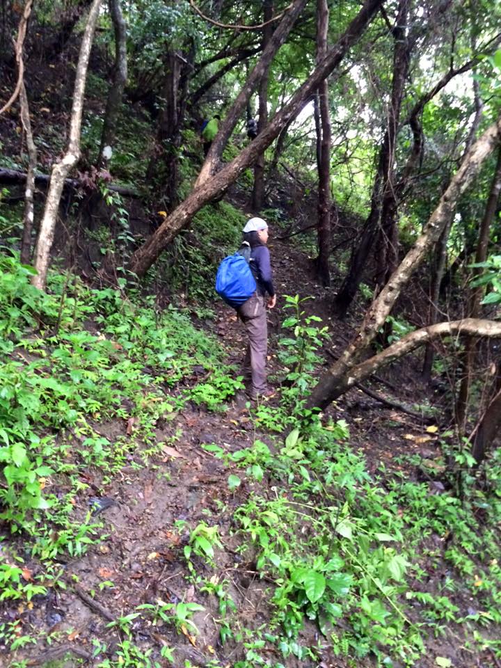
At first, we hiked more of grassland terrains and open areas.

We passed by a number of small falls. Afterwards, we entered the forest.


As I love taking pictures of anything that catch my attention, wow, look at these species that I have found!


Unfortunately, we weren't able to see rafflesia --- a very large, foul-smelling flower. During that time, all of them have already been decayed. Tatay Morot said, the perfect time when we can see them is during dry season.
We reached this point where a very huge rock is situated. This marks that we are almost there at the summit point. Unfortunately, fog has started to cover the surroungings as we ascend to the peak.

We even experienced a fine, misty rain. But that was way better than a very rainy trek. At around 10:30 am, we reached the summit. So here we go, still lucky trio with the whitish surroundings. We reached the summit anyway!
Atop the mountain is a giant rock which could have been visible if it weren't that foggy.

After eating our lunch under the huge rock which provided us enough shed during a short drizzle, we decided to descend. That was 11am.
As we descend we still had some picture takings. We encountered some windy areas though.

I was amused at this huge rock which made me feel like I am a dwarf. (by the way, a few steps down from there is another waterfalls).
These various waterfalls that we could view from where we are as we descend Napulak were so pleasing to our eyes. According to the guide, such mountain accross Napulak is higher than the former and it's called Mt. Taripis. There were already many instances that such mountain was climbed, however, it is Mt. Napulak I think that was popularly visited.


We arrived at the barangay chairman's house at 12:30pm. Several people from the households around couldn't believe that we were able to reach the summit. They thought we just backed out and did not continue to climb. They were puzzled that we were able to go down at that early. Hmmm, perhaps it's because we only carried light packs and we were just three people that we managed the phasing very well.
After eating lunch, we went down and continued the trekking. We were so grateful for the warm welcome of the household where we stayed overnight and for letting us leave some of our things while we climb the mountain.
Going back to the city, heavy rains poured down again. Thankful that the same level of rains was not experienced by us during the climb proper.
The whole climb went out fine except that we weren't able to have a good clearing atop the mountain. Hmmmm, a re-visit can be done in the future but I'll make sure that it won't happen in the same season as rainy as this.
Dayhike Proper
Having a very relaxing, cold morning, I struggled to get up. It was still raining. You know that feeling, right? It would never be easy, I swear. Again, I wished we just had to stay there and cuddled myself with a pillow on a very rainy day. To continue the daydreaming, sipping a hot brewed coffee and staring at the window - Isn't that more ideal to do? Hehe.
Nonetheless, we started to have a quick breakfast and prepared for the awaited dayhike. I glanced at the surroundings through the window of the nipa hut. The sky was cloudy. Sunrise wasn't visible. But I could see the pouring has started to slow down and the skies beginning to light up. It really gave us hope.
Thank you, Lord! At 6am, we were able to start the trek. No more rains but the muddy and slippery trails were those that challenged us the most.
At first, we hiked more of grassland terrains and open areas.

We passed by a number of small falls. Afterwards, we entered the forest.


As I love taking pictures of anything that catch my attention, wow, look at these species that I have found!


Unfortunately, we weren't able to see rafflesia --- a very large, foul-smelling flower. During that time, all of them have already been decayed. Tatay Morot said, the perfect time when we can see them is during dry season.
We reached this point where a very huge rock is situated. This marks that we are almost there at the summit point. Unfortunately, fog has started to cover the surroungings as we ascend to the peak.

We even experienced a fine, misty rain. But that was way better than a very rainy trek. At around 10:30 am, we reached the summit. So here we go, still lucky trio with the whitish surroundings. We reached the summit anyway!
 |
| Qitter, the photographer; myself and buddy Dennis |
Atop the mountain is a giant rock which could have been visible if it weren't that foggy.

After eating our lunch under the huge rock which provided us enough shed during a short drizzle, we decided to descend. That was 11am.
As we descend we still had some picture takings. We encountered some windy areas though.

I was amused at this huge rock which made me feel like I am a dwarf. (by the way, a few steps down from there is another waterfalls).
 |
| Dwarfed by a giant rock, I was a Thumbelina like that, hehe |
These various waterfalls that we could view from where we are as we descend Napulak were so pleasing to our eyes. According to the guide, such mountain accross Napulak is higher than the former and it's called Mt. Taripis. There were already many instances that such mountain was climbed, however, it is Mt. Napulak I think that was popularly visited.


We arrived at the barangay chairman's house at 12:30pm. Several people from the households around couldn't believe that we were able to reach the summit. They thought we just backed out and did not continue to climb. They were puzzled that we were able to go down at that early. Hmmm, perhaps it's because we only carried light packs and we were just three people that we managed the phasing very well.
After eating lunch, we went down and continued the trekking. We were so grateful for the warm welcome of the household where we stayed overnight and for letting us leave some of our things while we climb the mountain.
Going back to the city, heavy rains poured down again. Thankful that the same level of rains was not experienced by us during the climb proper.
The whole climb went out fine except that we weren't able to have a good clearing atop the mountain. Hmmmm, a re-visit can be done in the future but I'll make sure that it won't happen in the same season as rainy as this.


