Showing posts with label Dayhike. Show all posts

Monday, June 24, 2013

Zambales Series Part 2: Cinco Picos Dayhike Traverse to Silanguin Cove


One of the exciting portions of a climb event  is when you get the chance to have a side trip. How many of you wants to do more than one specific thing in an outdoor trip? No wonder anyone would not refuse a treat after tiring ascents and descents. No one would say a "no" to relax  or try something more. It may be a beach, falls, spelunking and other opportunities to maximize the trip. As mentioned in the first part of this Zambales series, this province offers a great deal of adventure --- climb and dive! trek and swim! drink and shrink! (what is "shrink?" hehe)

Indeed, it was a great weekend for us. After learning in our pre-climb meeting that Cinco Picos traverse can be done in one day and the other half of the trip would be spent at the beach, i felt a real excitement. I was anticipating a very "hayahay" event. (hayahay is a Bisaya term to depict comfort or refreshing mode).

I was already hearing the so called Cinco Picos back in 2011 during the early days of my hiking career (yes, career!) I told myself, it must be famous and it sounds cool. Yet I wasn't able to scale it, maybe because my heart was caught by other climb invites and that it is not yet an A-list to my invisible not-so-concrete bucket list.

They say it should be climbed during the rainy season. They say Zambales mountains are better be climbed during wet season. You will eventually agree that this can be true.

Alright, I ought to say it ----- the mountains are obviously bald, of grassland feature and really encourage a trek that is very direct to too much sun exposure.

The itinerary therefore was arranged to start very early to lessen the time spent when the extreme heat of the sun has finally spread.
a breathtaking view of sunrise at the jump off point in Sitio Cawag
We arrived in Olongapo at around 3am. We started late. We only began the trek right after the crack of dawn so we have witnessed the sun rising so beautifully from the east at the very jump off point.The first part of the traverse was a real kind of hiking.. a rolling trail surrounded by mountains. The first ever stop for rest was in Pinaglabanan river. I was amazed by the serenity that the river brings. The place is so relaxing but of course we have to resume and continue the trek. 

One of our companions, Qitter, who also owns majority of these wonderful pics


We passed by dry rivers and so we went up and down of their rocks . I believe they were still dry since we are just approaching the rainy season. They still have some evidences of dry and hot summer.

The steady hiking continued and it was all tall grasses that we’ve seen. But I was amazed when we finally spotted the sillhouette of the five peaks from afar. These five peaks depict the very name of the mountain – Cinco Picos.

It must be the climate change! As early as 6:45am, the sunlight has scattered evenly and it was a kind of really irritating hot feeling to our skin. We stopped by another river where the last water source can be found. Beyond that point were all assaults already. The big challenge: the intense heat of the sun. There came a point that I was pissed off. That kind of tiring feeling but you cannot stop since there are no trees to provide a good shade. It was also dehydrating trekking at such long open trails. I was  only getting myself stressed out when I look and imagine Balingkilat next month. How much more difficulty are we going to suffer there with this kind of a sunny trek? I was planning to back out, honestly.


look at this grassland trail...
Going on with the trail, on our uppermost right side is the Subic Base while on the other side is all mountains including the mentioned giant Balingkilat. The dark clouds started to form. Half of us reached the first peak and we had an early lunch there. It was getting foggier and foggier then eventually started to rain. It was better and more managebale than such super sunny trek that we had earlier. Although, i found it a little annoying since it was indeed a long heavy rain.

Foggy view of Subic Base on my left whiile continuing my trek up Peak 1
See you in July Mt. Balingkilat!
We intended to wait for the others at first but since it was getting colder and the rain seemed not stopping, they decided to resume the trek. Yet i was a worrying "Ate" since the last half of the group included my two siblings and two of their friends. Although I was pretty sure they are alright as the tail/sweeper of the group was buddy Dennis, so I believed they were safe. All I had to do was to wait for them at a portion of the descent  where there was a huge rock and a shrub which seemed to cover me up. I’ve almost fallen asleep while standing there over a heavy pouring down of heavens. I was facing the side where Silanguin cove can be viewed already. Although we had a one-second glimpse of it on the first part of the descent, i think it could have been a perfect view if such nimbus clouds weren't there. I was praying then to let the rain stop but at the same time thankful because at least it must be easier to do the trek than managing the extreme heat of the sun. The trail is not so technical, it's just of course a little lengthy.

A supposed to be greater view of Silanguin Cove view while descending from Peak 1
These are the amazing peaks of Cinco Picos
Finally, buddy and “my angels” (my siblings and their friends) arrived and we continued the trek passing by some dry rocky river crossings. We had already viewed the beach and we knew we were approaching the seashore yet it’s not what happened. Our restless yet tired feet were further challenged by another series of a long steady trek – grassland, dry rocky river, grassland, dry rocky river, then finally sand.. and behold, our smile almost reached our ears upon seeing the shores only to find out that the resort that we’ve reserved was another one or two kilometers to trek in order to finally arrive.

Silanguin Cove and the Zambales mountains

So here we are and finally arrived at our destination after the traverse, Silanguin Cove, Yeah! There were some raining moments from time to time but as we could observe the angry dark clouds just stayed at the peaks of the mountains.

I like Silanguin Cove better than Nagsasa. Maybe it's because it's not like the former that is overcrowded. Silanguin Cove is more serene for me although it is an additonal 1-hour boat ride from and to Brgy. Pundaquit.

i wanna sing.. "there's a rainbow ALWAYS after the rain!"


Swimming, laughing, diving, eating fresh seafood, picture taking--- all the good things that beach life can offer.


By the way, we were able to add more yummy food to our table by asking the caretaker of the resort to cook some fresh fish for us.


'found so many dogs there, but found this one the most "gwapo" hehe

I must also commend the kindness of the local guides to us. They had been reliable and dependable companions throughout the memorable traverse.

Here are some important information:

Entry Point: Sitio Cawag, Subic, Zambales
Exit Point: Silanguin Cove, Brgy. Pundaquit, San Antonio, Zambales


(Actual Itinerary: We only hit 1 peak as we couldn't  continue due to heave rain, we opted to descend after Peak 1)

Day 1
1000 Take  Olongapo-bound bus,Victory Liner Pasay
0300 ETA Olongapo, eat breakfast at the nearby Chowking/Jollibee
0400 Take pre-arranged Jeepney to Sitio Cawag
0500 ETA Sitio Cawag
0530 Start Trek
0600 ETA Pinaglabanan River
0700 Grassland trek onwards
0830 Last water source before the Assault
1030 Reach Peak 1
1100 Lunch (before Descent)
0200 ETA Silanguin Cove
0300 Tidy up/swimming
0600 Dinner
0800 Socials
1030 Lights off


Day 2

0600 Breakfast
0700 Visit Lake side of the cove*
0800 Swimming/Beach Bumming
1200 Lunch
0200 ETD Silanguin Cove
0400 ETA Brgy Pundaquit
0430 ETD San Antonio; take Olongapo-bound Ordinary Bus
0545 ETA Olongapo
0630 Take Manila-Bound Bus at Viclory Liner
0900 ETA Manila

*According to the guide, a falls that is just 1-hour trek from Silangan Cove can be found and visited

I would like to share with you the lake they've found even if I wasn't able to see it personally. Here's what I've grabbed.

Thank you peeps for making this a wonderful and fun trip!
                                   

Now looking forward to the last leg of of this series: Mt. Balingkilat Dayhike. I am really hoping for a favorable weather and that the event shall push through.

Photo Credits: Qitter Vhostek and Reign Chyng
Read More »

Wednesday, May 29, 2013

Quadrilogy (4 Peaks) Dayhike


Not that I promote a crazy climb nor I tolerate an insane dayhike.. No! Not that I encourage you to do an unreasonable tiring climb. This is just an optional training climb. Anyway, let’s face it! Perhaps, even the most difficult mountain requires far more than half of your strength and resistance in doing this “4 peaks” dayhike. Name it –Halcon, Guiting-Guiting, Mantalingajan, Sicapoo, Dos Cuernos or Patukan.. and maybe in the same way, you’re bound to do a major  alpine climb. If you want to survive these difficult mountains, or if you’re aspiring to climb your dream mountain, preparation is not a joke. Practice makes perfect as the saying goes. I’m not saying you take it too seriously. Always remember that the very essence of climbing is to take delight in doing this found passion. So just take it lightly and enjoy the training climb.  At some point in your mountaineering life, you may probably realize that to be able to sustain, you have bear the pain.  Well maybe, you can only digest or accept this one if you have that burning desire to conquer yourself in greater summits or complete an epic traverse. You may completely get me if you are in your most passionate state of your desire to climb more mountains.

Guess what? I am a frustrated 4peaks dayhiker! Yes I am. I tried it twice. But it has always been just THREE peaks.Well, just remember my Nasugbu Trilogy dayhike, it’s three! But for those dayhike which intended to accomplish four, I’ve never succeeded yet. Let me tell you why.

By the way, I did two variations.

Makiling 2-PeakTraverse, Manabu Peak and Rockies in One Day

Mt. Makiling boasts its radiant beauty during the start of our traverse

My first attempt was in July 2011.It was my first time to do a dayhike with my climbing buddy, Dennis. My only dream climb then was Mt. Sicapoo as mentioned in my previous posts. To be able to succeed in this “first attempt” to do a major climb, I decided to first try the Ambaguio-Akiki trail in Mt. Pulag and Luzon321. But before these two, I wanted to undergo a series of training climbs that time which were regular weekend hikes and of course, this 4-peak dayhike. Here was the deal – Makiling traverse via Sto. Tomas – UP Los Banos  (which is of course, composed of 2 peaks already) and then we shall proceed to  Manabu Peak and finally Rockies. Technically,it’s a combination of your familiar Makiling traverse and 2-peak dayhike(Rockies-Manabu). We started at 7am and with so much unbridled limatik encounter (as it was rainy season), we arrived and finished at the UPLB at 1pm. After some quick wash up, we took the jeepney to Lipa and another ride thru tricycle to the jump-off point of Manabu in Brgy. Sta. Cruz. Sto Tomas,Batangas. However, nonstop rains challenged us a lot and the muddy trails (and one head lamp for two) caused us to slow down and become behind our itinerary. Apologies as I was a newbie dayhiker that time that I never thought that headlamp is always essential to a dayhike. I was taking it literally then --- I said to myself, “it’s a hiking on daytime anyway so why bother bringing a head light. LOL. How stupid!” From the peak of Manabu, we could already see Mt. Maculot covered by thick clouds. We were thinking by that time if we can still proceed to such next stop. Well we were probably convincing ourselves to something impossible. If you happened to read my post on 2-peak (Rockies-Manabu) dayhike, I told that it is advisable to climb Rockies first as jeepney or bus trip back to Lipa City is crucial after 6pm. It was only 7:30pm when we’re back to Manabu jump off point. Hopeless, my goodness! But here’s the most insane part of all --- apart from not being able to finish the fourth mountain for that day, the truth was we were considering a Mt. Arayat traverse dayhike scheduled on the following day!!! Whew! I even became a carrier of limatik from Batangas to Pampanga. Well, that was another experience, when a mountain leech stayed overnight inside my nose and only decided to loosen up upon being full when we arrived at the town of Dau. Here’s the thing: I may not be able to finish 4peaks on that faithful Saturday yet I was still able to still complete 4peaks on that weekend --- Peak 3 and Peak 2 of Makiling, Manabu Peak, and Arayat. What can I say? Convinced? Hehe.. Don’t get me wrong! I admit it’s not healthy anymore but it just happened that there was a committed scheduled climb with some BUSOG mountaineers (my friends in our mountaineering group) on that Sunday. And maybe, I underestimated the 4-peak dayhike that I thought it’s just an ordinary dayhike and I can manage easily Arayat traverse after doing such.


                               wet look during our Makiling traverse 
           (we're the only ones who  didn't mind the rampant limatik that rainy saturday)


the get up! sorry, just a newbie here at the jump off point in Manabu Peak haha
gloomy view of Malarayat range at the top of Manabu Peak


            first time encounter with the Bedural couple (Ed and Sha) in Manabu
                         together with  their friend, Benjo and Domeng


(Note: Makiling traverse is a major climb while Manabu and Rockies are both minor ones)

Suggested Itinerary


Makiling Traverse via Palanggana Trail (Peak 2 and Peak 3), Manabu and Maculot

0300 Meetup Alabang/Buendia
0400 ETD Sto.Tomas Markert
0600 ETA Sto.Tomas Market/Breaksfast/Buy Packed Lunch
0630 ETD to Palanggana Trail
0645 ETA Brgy. San Bartolome/Register/Last Preparation
0700 Start Trek
0715 ETA Cardiac Trail
0800 ETA Silyang Bato
0900 Melkas Ridge
0930 ETA Peak 3
1030 ETA Peak 2/Rest
1045 Start Descend
1200 ETA Aguila Base
1330 ETA Station 1/Quick Wash-up/Lunch
1400 ETD to Calamba Crossing
1500 ETA Calamba Crossing/ETD Transfer jeep going to Fiesta Mall
1530 ETA Fiesta Mall/ETD Take Tricycle to Manabu Jump-Off
1600 ETA Manabu JOP/Start Trek
1700 Manabu Peak/Rest/Take Pictures
1730 Start Descend
1830 ETA Manabu JOP/ Quick Dinner/ Proceed to Maculot
2000 ETA Maculot/Rockies/Macatmon JOP/Start Trek via Old Trail
2100 ETA Rockies/Macatmon
2115 Start Descend
2230 ETA Maculot JOP/Wash-up


Rockies-Malarayat Quadrilogy

During my second attempt, the deal was a Rockies- Malarayat quadro. We did it as Luzon321 climb was approaching, so I badly needed a training climb. That was sometime in October 2011. It is climbing the Rockies first and then Malarayat range in Batangas which is composed of Mt. Malipunyo(1005masl), Mt. Susong Dalaga (Maiden’s Breast) and Manabu Peak(760masl).  Malarayat is a range of mountains that lies in the provinces of Batangas and Laguna (a trail that ranges from Sto. Tomas, Batangas to San Pablo City, Laguna. There are, of course, other peaks but the mentioned three are the famous ones.

Risky Rockies

We traveled to Cuenca very early in the morning so we first completed the trek to Rockies. We finished early. It was unusual for me descending there as early as 9:30am. Afterwards, we’re bound to proceed to Brgy. Talisay in Lipa City, the entry point in Malipunyo and Susong Dalaga. We first took the Malipunyo side. We hired a guide for Mt. Malipunyo as this mountain, per policy, required guideship of around P800. The trek was very lengthy with no view at the summit and the only thing that makes you fulfilled is the fact that you finished it anyway. Although you will be still challenged by the trail as there are also some assault parts of the trek. There were plenty of lipa (a plant that creates an itchy-painful feeling when your skin accidentally touches its leaves). We finished such backtrail climb at around 3:30pm after starting up at 11:30am. That’s why, you would imagine me getting groggy already doing the next one, Mt. Susong Dalaga trek. From the first step at the jump off point, it was doing an assault climb all the way to summit because of its almost vertical trail. What’s annoying too is the not-so-established and messy trail. I was just wearing a trekking sandals that time and I got a lot of cuts in my feet. Who could enjoy that on a night trek, with almost no view at all upon arriving at the summit.  At 6pm, we started to climb it.The only reward? Well, we still reached the summit and I could finally mark this mountain with a big check. The only question was “when shall I get the eagerness to climb it again?” By the way, if you are atop Manabu Peak, you will see a great view of Susong Dalaga truly depicting a maiden’s breast. For me it was confidently lying there in a very perfect form.  Finally, after transferring to Manabu jump off point, there were no one at the house where the registration and logging should be done. We decided not to proceed. Well that’s the only reason why we were not able to complete the 4 peaks for the second time.

one of the Malipunyo trails

approaching the summit of Susong Dalaga Peak, it was this kind of sunset that we saw!

this grassland is the very peak of Susong Dalaga

(Note: All the concerned 4 peaks are individually major climbs. However, having it as Malarayat range climb is already major. Rockies is of course a minor climb)

Suggested Itinerary


Rockies and Malarayat Range (Malipunyo, Susung Dalaga, Manabu)

0100 Meetup Buendia Bus Bound Lemery
0200 ETD to Cuenca/Maculot JOP/Register
0500 ETA Cuenca/Take Trike/Start Trek
0600 ETA Rockies Summit/Peak/Take Picture/Breakfast
0630 Start Descend
0700 ETA Rockies JOP/Buy Pack Lunch/Proceed to Malarayat Range (Malipunyo)
0800 ETA Fiesta Mall/Take trike going to Malipunyo JOP
0830 ETA Malipunyo/Arrange Guide
0900 Start Trek
1100 ETA Malipunyo Summit/Take Pictures
1115 Start Descend (Back Trail)/Proceed to Susung Dalaga
1230 ETA Susong Dalaga JOP/Quick Lunch
1300 Start Trek
1500 Susong Dalaga Summit/Take Picture/Rest
1530 Start Descend
1630 ETA Susong Dalaga JOP/Proceed to Manabu via Tricycle
1700 ETA Manabu JOP/Start Trek
1800 Manabu Summit/Peak/Take Pictures/Rest
1830 Start Descend
1930 ETA Manabu JOP/Wash-up/Dinner
2100 ETD Manila

Just like the advantage of Nasugbu Trilogy, which seems to be the prequel of this post about training climbs, the proximity to Manila as well as low budget (around 1,500 assuming 2 pax)  are what make it advantageous. Imagine with such value of money and you can already explore 4 peaks.

The great thing about my first attempt to climb these peaks is that, it was first time to climb them all, oh except Makiling and Rockies. I had a good reason to climb and reach their summits. Unlike buddy Dennis who happened to climb them for the "nth time". Well, that’s his role being a climbing buddy—to accompany me. Thanks so much to you! (peace, Dennis!).

If you are interested or planning to do multi-peak dayhike, as I am always saying, believe that you can accomplish it. Again, pacing is sort of a crucial thing. Of course, this is given that you don’t have any advice from your doctor about your physical capabilities or any assessment about your body that may cause you to forgetting this crazy training climb. Again, believe that you accomplish it as in the course of doing a megatraverse or a very major 9/9 climb, you will face much more hardships. Again, just imagine one mountain with many peaks.

I am very glad thinking that finally, this experience of mine was written up. During the heights of my urge to climb more mountains, I never got enough time to put it in the chronicles of my mountaineering life.

I’ve tried.. and I am still looking forward to finally accomplishing FOUR in my next attempt.

Read More »

Tuesday, February 12, 2013

Rockies-Manabu Peak Twin Dayhike

Location: Rockies (Mt. Macatmon, Cuenca Batangas; Manabu Peak, (Sto. Tomas, Batangas)
Feb 2, 2013

Good thing there was something kind of an outdoor to look forward to and prepare for this year. So in preparation for our anticipated comeback to my once dream mountain (and now my favorite), Mt. Sicapoo, as scheduled on the last week of February, buddy Dennis organized a training climb for us-- this was the Rockies-Manabu peak twin dayhike.

This happened to be my very first hike for 2013. I was wondering, what if there's no other reason except for training climb, would I still climb those 2 peaks again? In this twin dayhike, it was my fourth time in Rockies and my 2nd time in Manabu Peak. (When I was a newbie, I often told myself not to go back to a specific mountain, once it's already reached then there's no more reason to climb it again). Yet there are always new things to encounter and  experiences to learn from. It's not only about mountain but about every moment that you experience and learn that matter.

The climb event itself was new to me. This was my first time to do this combo climb. I've been to these mountains but in separate climb events (As you may notice in the list of all my past climbs).

This double dayhike is popular to many hikers because of their proximity to one another in  Batangas province. Rockies is in Cuenca while Manabu's jump off point is only few hours away which is in Sto. Tomas. 

Taking the Lemery-bound bus, our first stop was Rockies.There's a helpful and logical reason  why it should be the Rockies to climb first instead of Manabu. It's because, at least even if you happened to finish by nightfall, tricycle may be rented in Manabu going back to Lipa for a Manila-bound bus unlike in Rockies in which beyond 5 or 6pm you can hardly find a jeep from Cuenca to Lipa.

We were 5 for this dayhike-- Yeth, Ayen, Eric, Dennis and me. What surprised us was the new trail up to camp site. According to the locals there, the trail was only opened Monday last week. And such was the first weekend for the climbers to hike on the new trail. Same same! But I think it's shorter than the old one but a bit steeper. And the locals have already their respective place/station for their sales of buko juice or halo2x.

There were many who climbed on that day including a big group from Sun power Binian.

After some stand-by's and much kwentuhan at the campsite, we started to ascend to Rockies. In this fourth time to ascend through the mountain's rocks, I used to remind myself to take note of the rock awaiting straight anyone's head but when I'm already there I always forgot and so I bumped my head to it again.

At the top of Rockies was the same amazement that I felt as I had on my first, second and third time there. The view of calm and serene Taal lake and surrounding mountains are breathtaking.


In our descent it seemed that the trail caused me to slow down because of the loose soil and rocks that made it slippery to walk on. Perhaps it's due to the fact that it's not yet fully established. The soil is not held in tact and the trail is kinda messy Thankful to the stems of plants at the side of the trail in which we could hold on to and prevent ourselves to slide down.

Right after we arrived back at the starting point, rains started to pour down and we were hesitant to proceed to Manabu Peak.

My instinct was, it could not be raining there and it's better to proceed with this two-peaks dayhike as it is our training climb. Besides, the rain was tolerable , I think. It was also Yeth's first time to do such double hike. And so we took risk and transferred to Sto. Tomas through two jeepney rides and a tricycle ride.

Hola sunny day! It was a very fine weather when we got there! I kinda revived myself from lots and lots of sleeping time during the rides. We prepared ourselves and began to trek. There was a great excitement in me going back to this mountain. The trail was very gradual at first and assaults can only be encountered before the kubo of Ka Perying. But he was not there (almost two years since he got his eyes medicated according to his brother who is now currently overseeing everything there) and there's still free coffee! According to him, he cannot make it a full coffee made of that from alamid (too costly) but instead is mixed with kapeng barako (a very popular coffee in Batangas). I was amazed when Tatay showed to us what the waste of alamid looks like and it's only like a normal coffee bean and not a pupu.A small bag of it is sold for Php100 and the bigger one for Php500. And those prices are already cheap because it is actually traded more than that price in the market.

the coffee bean

We resumed our trek and this time more assault trails were faced. Arriving at the grassland summit, there are already set tents and a good number of hikers staying for an overnight camp. I felt a little envy on the campers there because the weather is so good and obviously it's a perfect time to camp :)

Finally we reached the summit marked by a white cross. We felt every second at the top. There was a good clearing except for the side which we were supposed to view Mt. Maculot. Apparently it's still raining there because it was covered by thick clouds. This was the first time I greatly appreciated Malarayat range. Manabu was part of it along with Malipunyo and Susong Dalaga. My first time here was a rainy trek and foggy at the top. We were also able to view Mt. Mt. Cristobal and Banahaw on the other side (Quezon province).

the team at the top of Manabu Peak marked by the white cross
the Malarayat range including Malipunyo and Susong Dalaga as viewed from the top of Manabu peak


And whaaat? We forgot to bring head lamp. I actually brought one for this dayhike but I left my bag at the jump off point including the head lamp. Hurrily we descended and arrived back at the starting point already nightfall at around 6pm.

I was amused at myself because in this very first hike for the year, it appeared that I still behave like a newbie mountaineer who is very joyful and excited. It felt like I'm hiking for the first time and it really felt good. The passion will always be there, I guess.

Read More »

Saturday, December 1, 2012

Mt. Guiting-Guiting Traverse

Location: Sibuyan Island, Romblon
Entry to Exit Point: Olango, San Fernando to Tampayan, Magdiwang
2,058 Meters Above Sea Level
Difficulty: Major Climb, 9/9 

Nov 2-3, 2012

“Its unique features equate a different level of difficulty, yet one could witness breathtaking and spectacular views at the top and throughout the trek. Completing the traverse is indeed very rewarding.”

There's a perfect time for everything! Finally I had my fair share of Mt. Guiting-Guiting climb experience. Originally set April of this year but it was cancelled and so I set myself to target it again in June, which of course, is already rainy season and therefore it didn't materialize. I felt the urge though of still climbing it even if circumstances seemed not to allow me yet to go there. Came a time that I stopped planning to climb it but i'm too curious of what it feels like to conquer a mountain which they say is seriously tough. Actually, when my climb buddy, Dennis, climbed it for the first time in December last year, I requested him to pick up a stone for me so that I could have a reason to return it this 2012 (hey, we broke the Leave No trace Rule) I held on to that promise. (Side story: Buddy Dennis Hisanan, in his first time to climb G2 made it to finish the traverse in about 19-hour dayhike. Yes, a dayhike! ^_^ ).

So I set again a plan C setting the climb on the long weekend of November. Know what? I was  hesitating but still said Yes. Unsure. Admittedly, I was climbing with an incomplete excitement, not so mentally prepared, unsure and with pressure. Never knew something very beautiful memories and experiences awaited me upon climbing this mountain.

Mt. Guiting-guiting, in my opinion, is a dream mountain for every Filipino climbing enthusiast because of its intimidating difficulty that one could take pride upon every succesful conquest. Popularly  known as "G2" by the mountaineers
, it is considered as one of the most difficult and technically challenging mountains in the Philippines. Located in the heart of Sibuyan Island, Romblon, the traverse we successfully made was via San Fernando to Magdiwang. As of this blog, there are only two routes that can be done in climbing this mountain: first is the traditional trail in Sitio Tampayan, Magdiwang (backtrail) and the second one is the traverse, an entry point in Sitio Olango, Brgy. Espana, San Fernando exiting Magdiwang. The traverse was opened only in 2009 according to the guide, Tatay Remy Robiso, a popular guide of the traverse and one of those who pioneered the Olango trail. According to him, it was such a great accomplishment then for him when he was still a park ranger and working for DENR. In his opinion, the difficulty of this traverse is 10/9 since the traditional climb is already rated 9/9.

Targeting G2 will not only require strength in climbing it, but also patience in hassle rides. You need to find enjoyment in long sailing thru ferry. And so a very  long trip was faced by us in the quest of reaching the Sibuyan Island.


It was Wednesday then and the ship route to Romblon was only up to Odiongan (Tablas Island). We traveled to Batangas Port in the afternoon and it was almost 7pm when the ferry left the port). It was an irritating ride. We bought the Fiesta Class ticket (non-aircon) and I just have to say this without mentioning the name of the ferry—bed bugs are rampant. I could not sleep well. I even got my arms swollen because of the bites. I just thought we should have instead taken the aircon room even though it would cost us more bucks, at least it could have been a comfortable ride.


From Odiongan Port, we took two-hour  jeepney ride to San Agustin Port but unfortunately there was no trip that would directly transport us to Sibuyan. So we had to ride a motorboat but we had to alight first at Romblon Port and then ride another boat to Sibuyan. It was really a hassle but it’s part of the adventure! We arrived lunchtime at Ambulong Port in Magdiwang, Sibuyan Island and then proceeded to a pre-arranged tricycle ride to San Fernando. It was a rough road trip overlooking the seashore on the side. To add more hassle to what we’ve been through, we got one of the tires flat. So as Kuya driver replaces it, we were given a time to take some pictures on the seashore.

In a hurry to ride a boat at Romblon Port

unplanned stop over and picture taking (on our way to Sitio Olango)

We arrived at Tatay Remy’s house in Sitio Olango, Brgy Espana in San Fernando and then later had a meet-up and asked for the blessing of the town’s Mayor (actually we have been warned of the mountain’s difficulty). We spent the night at Tatay Remy’s house.


view of Mt. Guiting-Guiting from the town of San Fernando

ONE-DAY-UP TO SUMMIT (Olango Side)

At 2am the following day we're already up and prepared everything. We started the trek at 3:30am. Since we should arrive at the summit before nightfall and  we should reach each point at a designated time, we had to increase our pacing as much as possible. In a 30-minute steady hiking, we reached the Olango river. This is the first water source. We refilled our water bottles and containers. The next would only be at Camp 3 which we would probably hit before lunch. 


Just before leaving Camp 1

a very steep assault

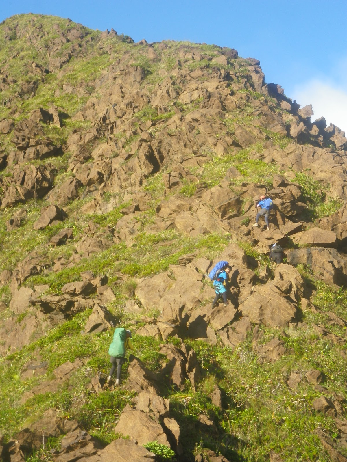
As we continue the trek, succeeding assault trails followed. It felt like it's a continuous cardiac trail of Mt. Makiling. We reached Camp 1 after more than an hour. Surprisingly, the next trail was literally rocks, both cliffs at each side . Truly, buddy Dennis is right when he told me that everything about the trail is rock. It' a very long steep climb, multiple times as Melkas ridge of Mt. Makiling. Just like what the guide says, anyone who does the traverse should have strong arms. Each step is literally a climb and one would require to exert his/her great effort in order to sustain the trail. To think, we just took the new trail called Team Outdoor Pilipinas and it's already tough. According to Tatay Remy, the old trail is harder-- a side trail directly facing the cliff. Throughout the trek, we encountered a number of beautiful flora and fauna and big pitcher plants. Some of them are same size as my shoes. On the other hand, buddy Dennis was not feeling well then. From time to time he threw up and he looked fainted. He was wondering, considering he already traversed the mountain through a dayhike last year and he was behaving like that. Probably it was because of  lack of sleep and he didn't eat before we get started. Tatay Remy was also already asking him if he could sustain the climb but he pushed through and he made it until Camp 3 where we ate our lunch and thankfully he has recharged himself. He’s back to life!


wonderful flora in the wild

pitcher plant

From such point, we were already behind our itinerary yet still within the maximum time we can stay there. Delayed though, the target was, we should be leaving Camp 3 by 1pm and favorably, at 12:45pm we were able to resume. From that point, we could completely view the rocky structure of the peaks of Mt. Guiting-Guiting. Extra care must be the first concern as when you look around, cliffs seem to scare you. The next target after Camp 3 was to reach the Crash site by 3pm. An open trail followed. There was an area there that I would not forget--- a side trek with a first glimpse of "kiss the wall" followed by a high assault by stepping into separate knife edge - shaped rock making a deep hole between the wall rock and such separate rock. Tatay Remy was supporting my steps.  I was shaking for the first time with the “127 hours” movie in my mind. It's my biggest fear—Rocks, where I could be hanging along the cliff (now you may question why I still climb even with such fears.. I don't know either. Perhaps, I just know I can overcome it).

I was shaking here!

We reached the crash site at 3:15pm and rested for a while. According to the guide, the site was already cleared  and apparently, the only thing that remained there was a wheel along with a small piece of rusty part of the plane. The crash happened in 1990 and the bodies of the crashed private plane (they say some sort of military) were only found after 2 years because during that time, the search was taken in Mindoro Island. And I think, no one from the locals or climbers could ever discovered them as the Olango side was not yet attempted then. We continued climbing an approximately 70 degree-open trail. I was reminiscing the trail to Mt. Apo from Lake Venado, It's like that grassland climb to the top. Arriving at the peak after a few minutes of assaut, a bouldering trail awaits. It was beautiful especially when the clouds disappeared which gave us a good clearing. I was in awe. Truly, only those who dare to take the risk and hardship will be given a beautiful reward like that, a chance to witness a wonderful creation. What surrounds us was a pile of big sharp rocks forming the mountain.  At this point, the porter went down for our last water source of the day. As of this blog, they say, such was newly discovered. Taking the name of the daughter of Romblon's governor, Trina, who has also already traversed the mountain. Hence, calling it Trina's Spring. 

At 4:10pm, we arrived at Remvaldely's Peak--- taken from the names of those who pioneered the traverse namely Remy, Valentin, Andy and Ely.


trekking up Remvaldely's Peak

Bouldering followed. Actually, approaching Remvaldely's peak is already rocky terrain. The challenge on the way to summit is that one would have to trek along such pile of large pointed rocks and a real effort is required. Holes are big threats of the trek. So as we mind the fact of tiring assault to the summit, we were also very focused on what our feet are walking at. It's very dangerous. That was sunset when we were doing the bouldering. As one or more peaks are shadowing the others, the sillhouette created is really scary because figures of sharp and pointed rocks are what we could obviously see. We enjoyed a very dramatic view of yellow orange sky along with the clouds.


G2 Sunset

Nightfall came and we haven't reached the summit because apparently, our strength were gradually deteriorating owing to the fact that we're almost 14 hour- trekking as of that moment. We continued anyway until we were able to get to the top! It felt great to have come to that point. 

We intended to set camp there but thankful to Tatay Remy for introducing to us a campsite covered by trees and there, we're free from the threats of too much cold temperature and strong winds. It was just a 10-15 trekking down from the summit. We ate our dinner, took a rest and did our much awaited time to slumber.

THE CLASSICAL TRAVERSE TO MAGDIWANG

It wasn't that cold, of course still cold but different to what I have expected.(or I must say, compared to the summit campsite if we decided to stay there). The covered campsite kept us safe and somehow warmed us for the whole night. After eating our breakfast and being done breaking the camp, we're back to the summit and ready to traverse. We were so blessed to have that start of morning with a very fine weather. 


To my surprise, we were able to spot the silhouette of Mt. Mayon which seemed to glance at us confidently with its perfect cone. That was the kind of clearing given to us on that faithful day! We were also able to see a part of Bicol region.


the perfect cone
I returned the stone at the summit symbolizing I was able to fulfill my promise of climbing it. After taking pictures of the wonderful views, we had to start the descent. We were actually behind the itinerary since the target was to leave the summit at 7am but we only got to start the traverse by 7:40 am.


I figured my subtitle here “Classical Traverse” is somewhat appropriate as the trails that we have taken on our descent are the trails where the first mountaineers who attempted to climb it were able to summit for the first time.  

It’s very difficult to descend given the fact that we had a very lengthy trek in the previous day. Most of all, the rocky terrain is really steep and cliffs seem to be very welcoming once you missed out stepping on the right rocks. Being very extra careful and focused is highly a must. As I look farther, anticipating the rocky terrain that we would be taking including the knife edged and Mayo’s Peak (which was then not so visible from where I was standing), my feet would not just want to move and step forward but all I thought was I wouldn't be able to finish the traverse and therefore won’t reach home.

I was shaking when we reached the 90-degree point. I thought it’s not possible to go down with my loaded backpack while stepping down into rocks without any aid of a rope. (good thing I am into light backpacking, hehe). But Tatay Remy was there and assisting me. I was able to do it! Whew, but I was really still shaking while sitting down and waiting for my other companions to take the same dangerous descent.I didn’t mind watching as they descend. It frightened me.

me--> at the 90-degree descent

More rocky descents followed-- then reaching the Peak of Deception with Mayon appearing on the other side from time to time and then down to Mabel’s Spring where we took a 15-minute rest. The first few hours of our descent already consumed a great amount of my strength and it made me slow down. I was able to regain my strength after eating spaghetti and some biscuits.

I was in awe again upon reaching the point where the saw-toothed peaks can be viewed closely. So, this is where the name of the mountain was originated-- Guiting-guiting which means "jagged."


The four of us- Dennis, Matelle, Ced and Benedict with the background of saw-toothed peaks

We reached the knife edge trail and I was back to life, our target was to reach Mayo’s Peak by 2pm. I enjoyed the trail. It was very dangerous, and it challenged me! What was on my mind then was: should I get back here after all of these and take again all of these difficulties? I also realized how I value my life that I have to be very careful every step of the way,of course with the mindset of successfully finishing it. Just like our journey in life, I guess.


Buddy pointing the trails we would be trekking at ahead including the knife-edged part
Mayo’s peak seemed to be unreachable and very far. We trekked, we trekked and we trekked and yet it was like we could not reach the peak.It was a very long knife edged trek to Mayo’s peak.


foggy trek on the rocky knife edge trail in the pursuit of reaching Mayo's Peak

Mayo's Peak

Reaching Mayo's peak finally, we took enough rest and later prepared to descend again. After a few minute-walk was a spacious campsite. And there are no more rocks! I was telling to Tatay Remy, "that kind is the mountain I know." From Mayo’s Peak to Guiting-Guiting summit down to the other side, it’s was a peculiar thing to me ^_^ A mountain of rocks, a pile of rocks, that’s G2!

We reached camp 3 at 4pm and it was kind of a long trek going to Camp 2, as we reached it at 5:55pm. It was only almost an hour down to camp 1. From there was totally night trek as we target the jump-off point in DENR Magdiwang. There are many forks along the way so we had to stay alert and follow the guide.  We reached the beautiful Catingas River with a moonlight and full of stars upon gazing above. After that was a gradual steady trek until finally reached DENR at 8:30pm.

And oh I could barely move my legs. We stayed at the resort of one of  Magdiwang’s officials.

The following day was a fine sunny day and smooth two-ferry trip to Batangas Port.Thankful to God, we made it! 

bidding goodbye to the mountain who challenged me a lot yet taught me not to give up. Til my next visit. :)


2 Day ITINERARY

Day 1 (WEDNESDAY) 
Manila Departure

01:00pm – Meeting place Batangas Pier. Final Preclimb, Last Minute Preparation
05:00pm – ETD Batangas for Romblon.

Day 2 (THURSDAY) 
Arrival to Sibuyan and Sidetrips

07:00am – ETA Romblon Port
10:00am – ETA Ambulong Port via MV Querubin
11:00am – Meet Sir Remy Robiso
12:00pm – ETD for Brgy. Espana, San Fernando via Chartered Jeepney
01:00pm – ETA Brgy. Espana at Sir Remy’s House
02:00pm – Sidetrips. Lagting Falls, Cantingas Dive, MV Princess of the Stars
05:00pm – Overnight at Sir Remy’s place.

Day 3 (FRIDAY) 
Assault to G2 Summit

12:00am – Wake-up Call, fix things/final preparation, breakfast
02:00am – Start Night Trek (wide trail, level trekking)
03:00am – ETA Olango River, last water source on trail (next water source at Olango’s Camp 3)
03:15am – Start of forest line (assault with bouldering/semi-rock-climbing)
05:00am – ETA Olango’s Camp 1 take 15 minute break, mini breakfast
05:15am – Ascend to Camp 2 via the Newly opened Outdoor Pilipinas Trail Location: N12.40790 E122.55009 986 MASL to N12.41105 E122.55836 1322MASL (steep with mini 60-80 degrees knife-edge ridges)
08:30am – ETA Olango’s Camp 2, breakfast
09:00am – Resume assault to Olango’s Camp 3 (mild assault, less boulders/obstacle courses)
09:15am – ETA open ridge trail, with boulders
09:45am – ETA Helipad, resume assault to Camp 3
10:00am – Start of Olango Knife-Edge Ridge(parallel to Southern Ridge of Mayo’s Peak)
10:15am – End of Knife-Edged Ridge, steep/final assault to Olango’s Camp 3
10:30am – ETA Camp3 water source at RemVal’s Spring 45 mins (one way) from Camp 3(c/o guides/porters) rest for 2 hours (30 mins and lunch 1 hour and 30 mins water procurement)
12:30pm – Start Assault to Remvaldely’s Peak, open grasslands, with “kiss the wall” parts, boulders, mini-rock climbing
02:00pm – ETA Crash Site
02:45pm – ETA RemValdely’s Peak, snacks
03:00pm – Resume trek, rolling terrain, all bouldering, with mini-knife-eged ridges
04:30pm – ETA G2 Summit, with very limited camping space, no water source, Location: N12.41632 E122.56874, pitch tents, dinner, socials

Day 4 (SATURDAY) 
Descent to Magdiwang via Traditional Trail

04:00am – Wake Up Call, breakfast, break camp
08:00am – Start Descent on Traditional Trail, all via reverse rock climbing
08:15am – ETA 90 degrees wall
09:00am – ETA Peak of Deception
10:30am – ETA Mabel’s Spring, water is available only if it rained in the previous days
10:45am – Resume trek, bouldering, will pass by “kiss the wall”
11:00am – Start of Knife-edged Ridge (slightly wide with mini-forest vs. misconception that it’s extremely narrow), rolling terrain, bouldering
03:00pm – ETA Mayo’s Peak, may have brief rest here or lunch, depending on actual ETA
03:30pm – ETA Bulod’s Spring, lunch
03:45pm – Resume descent, regular forest trail
04:00pm – ETA Magdiwang’s Camp 3
05:30pm – ETA Magdiwang’s Camp 2
06:00pm – ETA Magdiwang’s Camp 1
07:00pm – Out of forest trail, level trekking with river crossing
08:00pm – ETA DENR Tampayan, Magdiwang, Location N12.48268 E122.54974
09:00pm – Post Climb at Magdiwang or San Fernando

Day 5 (SUNDAY) 
Departure from Sibuyan to Batangas

05:00am – Wake Up call
06:00am – Quick breakfast
10:00am – ETD for Batangas Pier (Please contact sir Remy for scheduled trips to Batangas from Sibuyan)

Day 6 (MONDAY) 
Manila Return
03:00am – ETA Batangas Pier
05:00am – ETA Manila


Read More »
Related Posts Plugin for WordPress, Blogger...