Monday, August 25, 2014

First LUCP Basic Mountaineering Course Seminar

Until this time, it has been a continuous issue and argument whether Basic Mountaineering Course (BMC) should never be missed out by every outdoor man. Some say that you are not really a mountaineer if you haven't undergone such training. Honestly, I've been to more than fifty mountains, both major and minor ones, before I was able to take this chance of attending one. My claim before was that, having no BMC shouldn't be an issue to me since I get to learn gradually the essentials of outdoors through actual participation and exposure in the climb.  Besides, I can always surf the internet if   I want to do some research. Yet after attending this seminar sponsored by Let's Unite All The Climbers in the Philippines (LUCP), I've realized many things and was more enlightened about the outdoors.


Over a month ago, buddy Dennis told me about joining the said BMC. I couldn't refuse as it was actually our plan to attend such kind of seminar even before but just happened that it did not match our schedule. This time, I knew we'd make it.

This BMC seminar was initiated and was made possible by Sir Bong Magana, one of the administrators of LUCP along with the help and support of his team and other mountaineering friends. Held in Mt. Manalmon last August 16-17 2014, it was volunteered and facilitated by those people with good names and great experiences in mountaineering.  LUCP is a mountaineering community/page in facebook where various climb-related matters are discussed by its members.

By the way, because of some concerns, Buddy and I were not able to come early so we missed the first session which I think is about planning and preparation (sadly, the very basic). The seminar had some other courses which I would be sharing with you in this post. We also did not attended the ropemanship session as we need to go back home the next day as early as possible.

But what really is BMC? From the word itself, it's about learning the basic -- planning, preparation, budgeting, knowing what you climb, organizing and do's and don'ts of the outdoors. If you depart from the basic, something, if not totally, could possibly go wrong. It's like SOP (Standard Operating Procedures) of every climb. Since I have missed out the basic, I will instead turned you to the internet and found this UPM's file: UPM BASIC MOUNTAINEERING COURSE No. 1

Without any further defensive explanation, let me now share with you some learnings I got from the speakers who were eager and generous to share their knowledge.
  • Navigation (Speaker: Jong Narciso)

A compass is an essential tool in the wilderness survival. In this session, we were taught how to check and gather one's bearings. We were given some exercises. I have also learned that a map won't be useful without  the accompaniment of compass. Yeah, I guess I need more exercises on this.

Well, I don't know what I've been doing during my "Girl Scout" days that it's like it was my first time to hold and learn how to use the compass. Hehehe. The more insulting part was that I have a digital compass in my phone and yet I've never attempted to use it nor give time to be curious on how it operates.


  • First Aid (Speaker: Filmann Mapalad)

A -ask for help
I - intervene
D- do no further harm

The objectives of first aid:
"To minimize the pain and injury and save lives."

Similar to any company or institution, a group of climbers doing a particular trek should always have a designated first aider. I believe knowing how to apply first aid is one of the knowledge and skills that a mountaineer should possess since injuries can always happen during the climb. It is necessary and advantageous to be aware of helpful responsive actions in case of ailment and injuries.Two important things before rendering first aid are to introduce oneself first and then take responsibility. Sir Filmann also discussed about the barriers, equipments/tools, hindrances and emergency fundamentals of applying first aid as well as the essentials of a first aider.
  • High Altitude Mountaineering (Speaker: Regie Pablo)

The topic was quite interesting especially for those participants who aim to bring themselves into the next level of mountaineering. The speaker was no other than a successful Filipino Everest climber (who took the northern trail and the hardest route possible to the summit). And I'm one of those who dream bigger. But it pays to achieve those big dreams because of  the challenge of raising money for the climb and the climbing equipments. Apart from this, it apparently requires a far greater level of endurance. High altitude mountaineering is not for everyone. Sir Regie mentioned about assessing one's self first through Mt. Kinabalu climb, it's a 4,000MASL mountain and if you got no problem climbing it, then you have a chance in alpine mountaineering.

High altitude mountaineering involves a conditions of glacier problem and the mountain should be above 4,000MASL. Part of his discussion is the records/history of humankind in discovering the highest of the highest mountains in the world. He provided some tips on the best time to hike Mt. Everest and other Himalayan mountains. Mountains in Taiwan, New Zealand and India are among those that he recommended to give out a try because organizing climbs in this countries are at least cheaper than any other.  I was inspired by his stories and he even got a frostbite in one of his thumbs. What a passionate climber!

He showed to us the alpine climbing equipments and I found it exciting though I realized, "sa dami at bigat pa lang ng gears, ubos na agad ang lakas ko." LOL! Numerous pieces of advice were given in terms of organizing climbs, finding sponsors and finding the right climbing companions. He said, "mountaineering is a shared responsibiliy, so choose your companions in forming the team.

  • Leave No Trace (LNT) Rule (Speaker: Mister LNT)

The topic was facilitated by Sir Lito, a.k.a. MisterLNT. I admire his advocacy to practice the responsible mountaineering. You may find him at facebook but here is his official website: misterLNT.ph


The session was made active and creative. We were divided into groups and each group should do a presentation related to the assigned  LNT rule.  Some performed a drama skit to portray a particular LNT rule, other made something like a Q&A presentation. Others in the room were allowed to raise questions and clarifications.

 
  • Introduction to Jungle Survival (Speaker: Jay-Z Jorge)

According to Sir Jay-Z, the talk is only an introduction as learning survival skills entails spending 2 or 3 days. The magic word for survival is S.T.O.P (Stop, Think, Organize, Plan). The highlight of his discussion was about the 10 C's of survivability which are as follows:

1. Cutting Tool
2. Combustion
3. Cover
4. Container
5. Cordage
6. Candle
7. Cotton
8.Compass
9. Cargo Tape
10. Canvass Needle

The crucial point about survival is the combined application of knowledge, skills and attitude. Having a presence of mind and avoiding panic can save lives and go a long way in times of survival.

If I could turn back time and redo everything, I wish I have attended the BMC seminar like this in the early days of my mountaineering activities before I got to climb a lot of peaks. Being well-oriented of the basic and other outdoor matters before encountering the actual scenarios in the wilderness has its real advantage than having nothing at all. 

Yes, I got you, there is always an internet to which you can get a lot of information. Just like this, I'm sharing some information and it's actually available right there at your fingertips through your phones or laptops. But I am telling you, being in the actual learning and workshop is better than mere reading a file from the internet or a book. Besides, you can also have a chance to mingle with fellow outdoor people who can give you actual sharing of his/her experiences. You can even know how first aid is actually applied, how a bandage is prepared, how you operate a compass and many more. You can raise questions and get instant clarifications from the resource speaker or instructor in case a resource material failed to discuss a certain matter. Taking the BMC, you have the "actual feel" of everything.

I thank LUCP for this initiative and I would like to give compliments on all the efforts to make this event possible. I take pride being part of its first ever batch with a great hope that what we've learned will be properly applied and all wrongdoings in the past will be changed and corrected going forward.

Mountaineering is a risky hobby and a dangerous activity. Accidents can happen but if you know and follow the proper ways of doing it, well, you are on the right track and you can enjoy the most out of all the good experiences that mountaineering can offer.

Guys, allow yourself to be trained! Be well-oriented about your chosen hobby. Yeah, there's a part 2!  LUCP BMC Batch 2 is coming up this September 6-7 at the jump off point of Manabu Peak in Batangas. You may contact Bong Magana or find the LUCP facebook group.


P.S. 

This BMC had exciting raffle draw portions from some mountaineer sponsors. Items that were given away include hammock, head lamp and a lot of coin purse. Thanks Tingguian Tribe for this awesome coin purse! Surely it's gonna be useful.

Read More »

Sunday, August 3, 2014

Announcing My 4th Annual Mt. Pulag Climb: Climb with Me! :)

Dearest Viewers,

Add another adventurous stuff to your bucket list! See for yourself the famous beauty of Luzon's highest peak! Meet new friends! And whether you are a newbie or a regular climber of Mt. Pulag for the "nth" time --- Hurry! secure your slot this early, invite your friends, grab your backpack and climb with me!
"Sea of Clouds" (Photo taken from Dennis Hisanan)

How much?


Php2,950 only!!!!
(inclusive of all required climbing fees, event shirt and 2 meals - Dinner and Breakfast, bus fare from Manila to Baguio and V.V.)
 

Required Down payment: Php1,000 (for ticket reservations and shirt) on or before 24Oct14)
BPI Account (Net Quad, BGC Branch): Ma. Stella Sophia Rivera 2663-0060-72


When?


December 20 - 21, 2014 (Date of Departure from Manila: 10pm of December 19)
Pre-climb Meeting: Nov. 25, 2014


Where?


Kabayan, Benguet (Bus Ride through Victory Liner to Baguio City and Jeepney Ride to Bokod, Benguet)


Features of the Climb? What to Expect?


Luzon's highest and Country's 3rd Highest. Sea of Clouds (if lucky enough). Pine trees. Cold weather of the Cordillera region. Dwarf bamboos. Via Ambangeg trail, which is considered a minor climb and advisable to newbies. For the veteran ones, it's like a "chillax" climb.


Basic Tips?


>At least jog or do some work outs few days before the climb
> Attend the pre-climb meeting
> Pay for the required downpayment
> Especially for the newbies, while it's early, start to collect/borrow the necessary gears:
(tent with fly sheet, jacket with fleece, bonnet, arm warmer,gloves, trekking shoes or sandals, raincoat)


Any Helpful Links?

mt. pulag (pinoymountaineer.com)
3rd Annual Mt. Pulag Climb
First Step in Mt. Pulag: Astonished!
If You are Climbing for the First Time


Contact me ASAP! Send your PMs thru ma.stella.sophia.rivera@gmail.com. I'd like to hear from you soon.

Lots of Love,
bluish trekker ^_^


P.S.

Like me on Facebook:

Bluish Trekker @ Facebook
Read More »

Tuesday, July 29, 2014

Sunset Stories


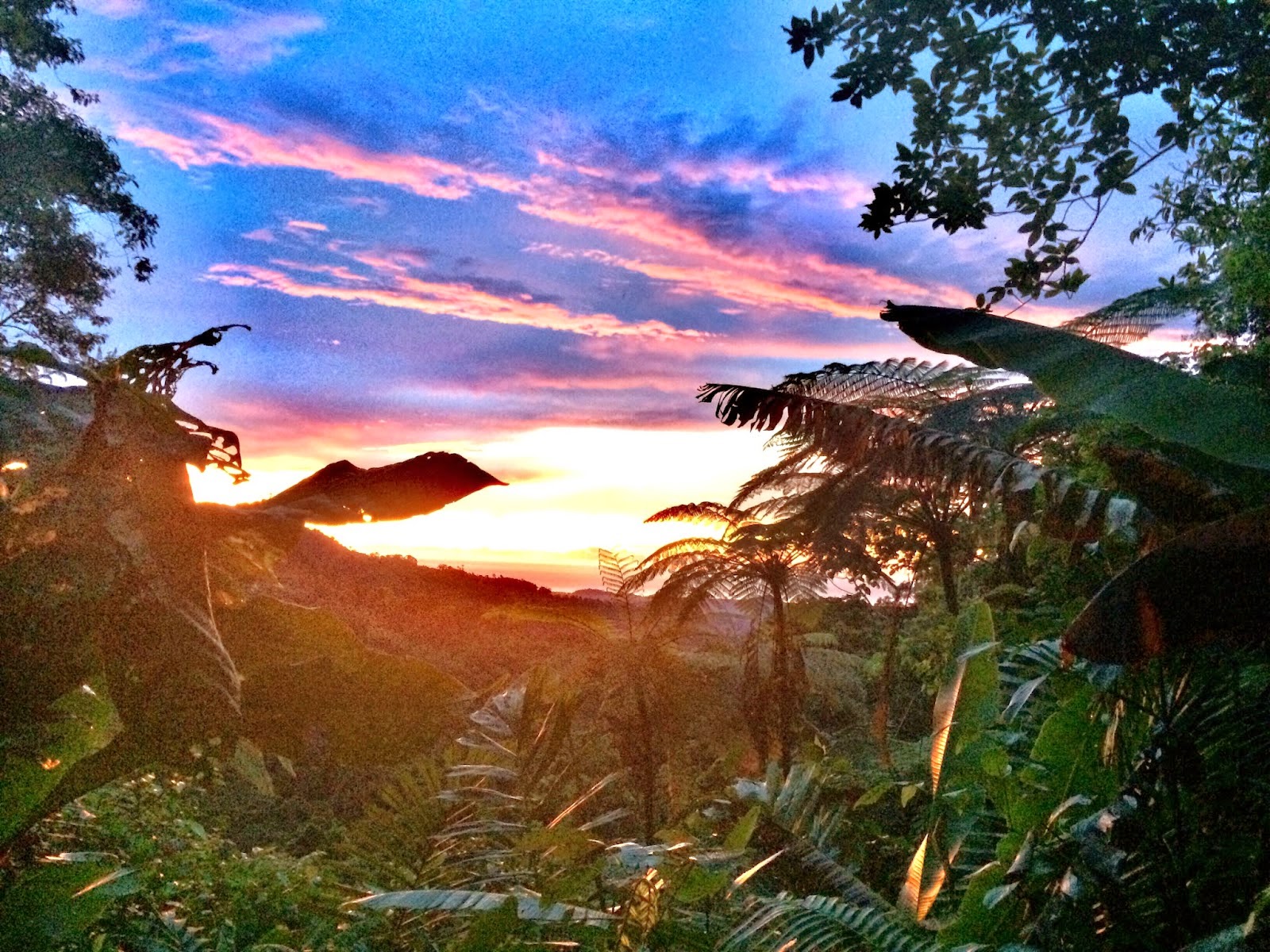
It’s almost dusk and darkness is about to cover the surroundings. Yet, before it completely shuts the daylight down, a pink, yellow-orange sky is painted in the sky.

Oh I guess, I am really a sentimental person. Because if not, I would not be able to write something like this. I would not even waste my time and make a post just to detail what the heck is sunset for me. But tell me, isn’t it that you are also one of those people who can’t help but marvel over a perfect sunset moment? Witnessing a very dramatic sunset could be overwhelming and the joy it brings is unexplainable that it just makes one’s heart leap for joy.

One of my favorite shots when I climb mountain is the sunset. Being atop the mountain while seeing for myself the conquering darkness and perfect sunset battle at twilight is one of the most favored moments of my life. When you are granted with a good view of sunset, very often that it means you are also given a  favorable weather for your climb. By the way, I put more weight and preference on sunset over sunrise. Sunset is always beautiful but I think you will also agree with me that even so, sunset is better appreciated and viewed from the seashore, from the mountains or from anywhere purely nature than when you spot it from the city. I've been to different mountains and I was able to collect sunset experiences that I would like to have some flashback. I may not have the most beautiful captured sunsets but let me share them with you anyway (it was actually a compilation as the photos below were already posted and included per mountain/climb story of this blog). Well, still, they are somehow worth remembering.

  • Mt. Kinabalu, Malaysia  (November 2013)

Viewing this impressive sundown made me left for a while my buffet dinner at Laban Rata Lodge because all I wanted to do was to wonder at what I see amidst very, very cold weather outside and never miss out any amazing moment. Such a romantic scene that I called Buddy to watch it with me.

  • Mt. Guiting-Guiting, Romblon (November 2012)


 I have forgotten my tiredness brought about by trekking since 3:30AM on that day because I got to witness this simple treat from the sky --- a beautiful sunset.

  • Mt. Batulao, Batangas (January 2014)


Before nightfall sweeps off the view of the fabulous mountain range of Mt. Batulao, here's what we got -- an equally fabulous sun coming down from above!

  • Mt. Simagaysay, Ilocos Norte (February 2012)


In completing the Mt. Sicapoo traverse in Ilocos back in 2012, what could be more motivating being in the third day of the trek with an average of 8-10 hours walk per day than having a plenty of water and by being rewarded by this perfect sunset from the 360-degree view trails of Mt. Simagaysay.

  • Maranat Falls, Bulacan (June 2014)


Who could have thought that just a few minutes away from the metro lies a very serene and pleasant hiking destination where sunset also appears to be so stunning. It was overwhelming while taking a snapshot of it from the campsite.

  • Balin-balin Village, Mt. Mantalingajan, Palawan (May 2014)


The peaceful living at Balin-balin is also mixed with peaceful twilight like this brought by the sweet setting of the sun from behind.

  • An Ascent from Kabugan Campsite, Mt. Mantalingajan Traverse, Palawan (May 2014)


The whole day might be a non-stop rainy trek for us but the heavens promised a beautiful ending for our Day 1 trek to Mantalingajan -- a pinkish sunset.
  • Paray-Paray Campsite, Mt. Mantalingajan Traverse, Palawan (May 2014)


I was hoping for another pinkish sunset in our Day 2 trek in Mt. Mantalingajan. But I felt happier at what we saw. It was a glancing and hiding sun over a cloudy side of Ransang, Palawan. This was viewed from the water source (small creek) that can be found just a few minutes away from Paray-paray campsite.

  • Mt. Tagpew, Kibungan Circuit, Benguet (February 2014)


Oooops, when I say sunset photo I mean not the literal, complete view of the sundown. It could also mean a hidden sunset. I called it a "lingering sunset." It was such a fantastic reflection of the red-orange light of the sun but we could not view it because the campsite in this side of Benguet is covered by  trees. 

  • Pico De Loro, Batangas/Cavite (June 2011)

It was almost dusk but still there was a trace of sunset at these crocodile-like islets viewed from the summit of Pico de Loro.

For me, sunset is such a sweet finale.  The sun seems to bid goodbye telling me that, “hey, it might be a long, tiring day, but watch me as I spread the last strike of my light, it’s still a wonderful day anyway!” Sunset conveys a message that another page is added to my life and is brought now to memory. It seems to give a retro feeling that you may want to reflect and recall all the happenings on that particular day. Sunset makes a promise that he would hide for a while but he will definitely shine the next day. It tells that life is fantastic... that there is always something to celebrate. It portrays hope and gratefulness.

I thank God for the sunset. It is the expression of His wondrous deeds.

I'm pretty sure your captured sunset photos are far better than these. And you will always recall those moments when you got to witness it for yourself. Now, what are your sunset stories?
Read More »

Sunday, July 6, 2014

Maranat: Simply Hidden and Serene

It was only this year that I heard a lot about Maranat. I just recently saw a lot of facebook uploads about it. 'Sounds something unusual! Then I got my chance to visit it. =)

I can say Maranat is unique in different ways. It's not a typical mountain where you would expect a highest peak or a summit. Really, it is not. But of course it's still a mountain and they say it's part of Sierra Madre range (most likely Mt. Oriod). 
Maranat is also a close neighbor to Mt. Balagbag. In fact, its jump off point is in Licao-licao in Rodriguez, Rizal which is similar to Mt. Balagbag. Ting ting ting! The good news? Well, obviously it's just somewhere near Manila and it's easy to get there. What I am also amused about is that it is not a traverse-type of a climb and yet the trekking itself is passing through the boundaries of two provinces, that is, making an entry point in Rizal walking all the way to Bulacan, specifically the town of San Jose del Monte. (It is said to be almost within the area of Norzagaray town, also in Bulacan).

The Highlight 


So what is special about Maranat? Instead of looking forward to a fulfillment by reaching a summit, one would equally be satisfied by its ultimate final destination -- its beautiful falls hidden in the middle of the mountain along with serene campsite overseen by a local named Tatay Nestor who also owns a nipa hut there.

The Trail

One may not anticipate any highest peak yet an alternate ascending and descending trails are still part of the trek. Around 10-15mins after the start up from Licao-licao, there's a point where instead of straight direction (which is heading to Balagbag), getting to Maranat would mean taking the left turn. Oh I missed taking a snapshot of it, but i am 100% sure it's easy to find  and is obvious because otherwise, heading straight would mean ending up with an open trail to Mt. Balagbag trail.


The first part of the trek (more than 1 hour I guess) is fairly easy passing through various residential areas. However, during that weekend that we did the trek, the terrain made it a little more challenging for us because it was muddy and we could not trust on both rocks and muds as they are really slippery to step at. (It's June and the past days/week had been a sort of rainy).


A very relaxing nipa hut along the trail can be found after a couple of minutes. Afterwards, we encountered a steady trail with a mix of ascending and descending ones. The trails then become open and more of grassland.


But that's situated in another mountain. This means that we have to take a deep, steep, rocky downward trail to get to the river and after crossing such river, we need to ascend the next mountain.


Walking after less than an hour, we could already view the campsite and the falls beside it which both seem to encourage us more to continue with the trek. From that point, I couldn't wait to finally get there!


The trail going down is muddy and cautions must be observed as it is dangerous, steep and slippery.


Assisted by our guy companions, it wasn't too difficult to get to the other side of the river even if the water level is almost waist high of my height. Of course, it could be risky or not passable when there's an inclement weather where water level can drastically rise.
 
This area is a sort of zipline wire to get to the other side. Got no idea when it can be operated or used
As expected, the backtrail is a bit longer as this descent trail that we took was the same trail that we had to ascend on our way back. It's the total opposite of the normal climb. Going to Maranat is more of downward trail while going back home is like you just get to start climbing a mountain.


Actual number of hours during our ascent (with a lot of rest): 3.5 hours

Actual number of hours on our descent: 2.8 hours

Blissful Camping

After enduring a 10-15 minute ascent from the river, we reached the campsite. A nipa hut was the very first thing that we saw. 


Below were two of the cute and playful pets of Tatay Nestor which seem to be so homey and are used to a life in the mountain.


 Tatay Nestor gave us a warm welcome and was very accomodating to us. He even told us some trivia and stories of his past travel and adventures.   


This one reminds me of my childhood as I remember it so plentiful during summer. It's called "talutot" in our town. Oh forgive me that I forgot from which tree it came from.


We chose the camping area which is just 5 minutes away from the falls. The camping ground is not that flat making you to slightly slant when lying down but nevertheless still suitable for setting a tent. Water source is absolutely not a problem as aside from the fact that the campsite is close to the falls, Tatay Nestor has water hose/system.  We were even able to take a good bath as we can freely use their comfort room and bathroom. I have learned that many of the mountaineers there are avid campers of Maranat and are resident climbers as one of them claimed. This climber has mentioned that staying there more than the normal overnight climb is not new to her. I have heard from Tatay Nestor himself that there are a few climbers there who have stayed for more or less than one month. But it's really not that surprising. I cannot question them. Staying there is satisfying and soothing and if you are looking for serenity and simplicity -- fresh air, abundant water, refreshing nature, quiet place --- well, it appears like you can no longer ask for more. Tatay Nestor even told us that when heat strikes during lunch time, he simply goes to the falls, listens to the water flows and feels the refreshing water then he's fine and cooled down afterwards.

I have only one comment. There are plenty of mosquitoes and I find them so annoying. Until this write up or two weeks after the climb, several marks of their bites are still visible in my skin and are very itchy (Well, I don't know if that goes by the blood type because eversince I am mosquitoes' favorite).
By the way, heavy rains disturbed us during the night. Indeed, it's rainy season already.

The second day was maximizing the stay and enjoyment at the falls. We were able to reach the farthest one. Water is so abundant and free flowing. I honestly wanted to stay for one more night if only I had no work the following day.


I asked Tatay Nestor how Maranat started to become known to many climbers. He said it began when Sagip Kagubatan was formed and when a good and nature-concerned person named Oliver Solomon expressed the willingness to help him plant more trees and save the mountains. Tatay Nestor willingly told us about his life and how he got to Maranat. One thing he is advocate of is to save the nature. For him, reforestation is actually not the absolute solution nor the annual budget that government appropriates on it, it is being "hands on" and proper monitoring that can totally solve the problem.

Coaling is the primary source of livelihood in Maranat but it has also caused the mountain to lack more trees and has triggered erosions. This, according to Tatay Nestor if not replaced with new trees can cause worse flood or clean water shortage to Metro Manila and nearby areas. That's his only concern. He wants the future not to suffer and he is totally thankful to Sagip Kagubatan for the initiatives it has done already.


This bald area of the mountain has actually a portion with soil erosion. 


Such weekend may have an abnormal weather (a quick alternate of sunny and rainy), but it let us experience a great time of adventure and a good feel of nature. In the future, I am looking forward to be back to this paradise-like Maranat -- simple, hidden and serene. (I'll have my mosquito bites healed at least hehe).  

How to Get There?

1. Take a bus in EDSA going to Tungko.
2. Alight in Tungko and go to the market which has a terminal of jeepneys going to Licao-licao.
3. Drop off in Licao-Licao
4. Take a tricycle going to Barangay hall for registration.

*Getting a chartered jeepney is also advisable for convenience

Safe Budget (for an overnight Climb for a minimum of 10 pax): Php 500
Read More »

Friday, May 30, 2014

Mt. Mantalingajan Traverse: A Journey Completed, A Dream Realized


Note: This post, just like the first two parts of my Knife Edge Trilogy climb (Guiting-guiting and Halcon), is quite long. I preferred to diarize every thought and every detail of the experiences I encountered. Only those patient and interested to know the journey I've been with are encouraged to read this. However, I will be disclosing our actual itinerary upon any request and will be sharing the source of info  that made this climb possible.

An opportune time of having a long break plus a great of amount of courage and inner strength, added by a  small amount of craziness– these enkindled me in turning my dream of completing the last leg of my Knife Edge Trilogy target into a reality. The Knife Edge Trilogy climb, as mentioned in my previous posts, is known to Philippine mountaineering as three mountains in the MIMAROPA region (Mindoro, Marinduque, Romblon and Palawan) in which a treacherous knife edge-like trail are common to each of them, thereby, given a 9/9 difficulty rating. In November 2012, I was able to do the Mt. Guiting-guiting traverse in Romblon and in July 2013, I realized the dream of reaching Mt. Halcon. This year, it’s time for Mt. Mantalingajan in southern Palawan. :)
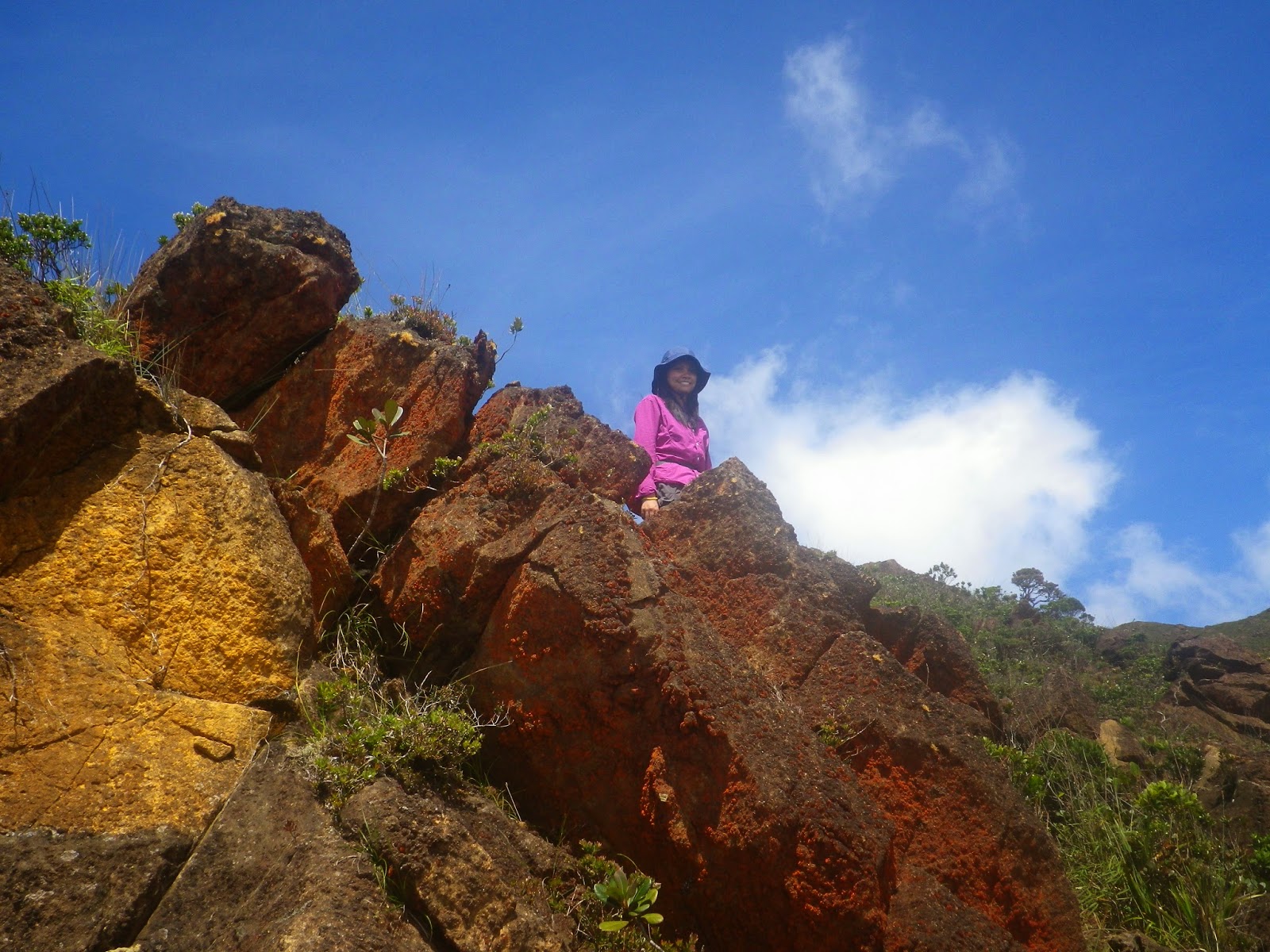
rocky terrain approaching the summit of Mantalingajan

Mantalingajan was really a target climb of mine this year, but maybe, I am just a woman whose mind is sometimes really hard to read and i am a bit hesitant. Also, I was cornered by some financial constraints. Moreover, another thing that made me forget it was when I heard the news early this year that a group who climbed there was shot by an unknown gunman (I have confirmed it and heard the details personally from Kuya Binoy, the guide in our actual climb). However, as my mandatory leave was fast approaching in May, it was only in the second week of the said month did I finally decide and take the risks. Even if I would go on solo, even if buddy Dennis won’t be able to take a leave and accompany me and even if at the back of mind, I was really scared (of snakes, of malaria, of the fact that it’s difficulty is 9/9, and the like).

I grabbed my PC and booked for a round trip flight. I was firm in this decision. I would be forever regretful if I had this long vacation and a good chance to climb it and I just let the opportunity slip in.

Buddy Dennis,  on the other hand, was also ever supportive of this. He was actually one of the reasons why I was having the strength.    

The unfavorable results? I only got a discounted air fare (not-so-good discounted fare) in my return to Manila. And so, I say “hello and good luck” to my bills for my booked flight going to Palawan. I might add that I had to bear the difficulty in finding for companions because it was a sudden invite for a climb, and take note, it’s not just a simple, but a very serious climb.

Buddy and I still patiently looked for any interested climbers who could join me in such impossible situation. Haha.. There were many of them who were interested but no one was available. A fellow climber who was once a companion in a dayhike back in 2011, in the person of Angelo Cruz,  texted me and expressed an interest to join. He would be there in Palawan on the same dates that I target to climb it. Shoot! I got a buddy to accompany me and to share the climb expenses with. (Anyway, I  was a little bit in folly to push through even if I’d go on solo, ‘sound s exciting actually). But it was truly better, there was Gelo!

>>> After some short planning, fast forward --->


Mount Mantalingajan: A Towering Gem of Palawan


With the height of 2,086+MASL, the summit of Mt. Mountalingajan is the highest point in Palawan.  Situated and surrounded by various towns in southern Palawan, the mountain is a home to a tribe called “Tau’t Bato” and a habitat for many wonderful species.  It is considered as one of the toughest mountains to climb in the Philippines.  As mentioned above, its main feature is the knife edge trail which is really dangerous to walk at.


Talking about trekking in this mountain, the well-known and possible jump-off point is the one in Barangay Ransang, in the town of Rizal. A few years back, some climbers initiated a traverse trail which made the descent to the Barangay Malis (Brooke’s Point town) possible, hence, called the Ransang-Malis traverse. 

Mt. Mantalingajan as tracked by Garmin Oregon 550 showing a 43.6km traverse

During our actual climb, I asked our guide of any other possible trail in Mantalingajan and we learned that another traverse trail has been already doable but according to him, it's more difficult than the trail to Malis, that is, passing through the Kamhantian village, thus, calling it as traverse via Kamhantian trail.


Pre-climb Preparation


I found a friend‘s (Sha Bedural) blog post on Mantalingajan Traverse very helpful. I got the DENR contacts from her site (http://kscdrbedural.wordpress.com/2014/01/28/climb-guide-mt-mantalingajan-traverse/). 

We didn’t actually get a hard copy of climb permit. I don’t know if it’s because of an impulsive scheduling of the climb, or it’s just that there was a problem in the communication. We even dropped by at DENR – Quezon office during our trip to Ransang but still we failed to get one as Ms. Clarissa Pador was in a meeting in Brooke’s Point. We really couldn’t get in touch with her thru mobile phone. On the other hand, the guide assured us that as long as it was already advised to the DENR, then it’s enough. It was just uncertain on our part since we wouldn't be able show any proof that we were really authorized to climb if anything goes wrong. Aborting the climb was not an option as the trip is very tiring  and is far away from Puerto Princesa and we were already prepared for the climb.

I was also able to contact Kuya Binoy thru Sha’s blog, too. For us to minimize climb expenses, our initial arrangement was, he would be our porter-guide and as much as possible, not to get another person to be our porter. By the way, they say it is only Kuya Binoy and his uncle, Tatay Dinyo who know the way to traverse the mountain.

Since Palawan is said to be infested by malaria especially in the past, we took some anti-malarial medicines to at least ensure ourselves with prevention of the said probable malady.


The Climb Proper


A day before the target Day1 of the climb, I left for Puerto Princesa and met Gelo. Good thing, he was staying at a relative’s house and so I was also invited to stay there instead of checking in a hostel or a lodge. It was a day of preparation, shopping for the food and camping supplies as well as cooking of some stuff in accordance to our meal plan.


Day 0 – Travel Time to the Town of Rizal


Taking the shuttle in San Jose Terminal going to Rizal town, we were able to ride the 6:30AM trip. However, if only we have known earlier that there was a 4:30AM trip (according to the driver/dispatcher there, that was the first trip), we could have arrived earlier in Rizal. This mistake resulted to accumulating delays in our itinerary. Our next transfer was via jeepney to Sitio Sicud and we should alight at Ransang. Unfortunately, upon our arrival in the Rizal Terminal, the jeepney going to Sicud had just left. We had to wait for one more hour for the next trip so we just used the time to have an express cooking of our rice. We were really behind the itinerary. We planned to start the trek by at least 1PM. Miscommunication on the meet up point with the guide; a rainy, bumpy  jeepney ride; a prolonged travel time due to some business trips of the driver --- I don’t want to state each and every detail of  these but all the worst things that could make us delayed, simply happened.

A road to Sicud: on the left side is the Chairman's house which is the climbers' drop off point for registration

The rain already stopped. We were only able to meet Kuya Binoy, 30 minutes past the hour of two in the afternoon. We were introduced to Kapitana, registered in the logbook and paid for the Visitor’s fee of Php100 each. To re-energize ourselves, we ate lunch first and because of these, we only managed to start the trek  at 3:30PM. Initially, we decided to hit the original target for the day which was Magtangob campsite or Bulldog’s house but on our way to Balin-balin Village (one hour trek  from the starting point), we already encountered two snakes (ulupong) along the trail. I was really scared! It was my first time to see an alive and crawling snake in the trail. Since it would take 4 hours or less from Balin-balin Village to Bulldog’s house, it means we need to do a night trek. We thought it's unsafe so we just settled to stay overnight at Balin-balin where house of Kuya Binoy and his family was also located. 

on our way to Balin-balin Village with Mantalingajan range on the background

the children of Balin-balin Village

Dusk at Balin-balin village

Few of the locals we encountered were wondering what on earth we are doing up in the mountains. They said, “bakit ba kayo umaakyat dyan? Anong ginagawa nyo? Buti nga kayo at nasa bayan na.” (Why are you climbing this mountain? What are you doing there? Don’t you realize you’re fortunate enough that you are residing in downtowns?)

I just smiled. Gelo said, “self-fulfillment”. When only three of us were left (Kuya Binoy, Gelo and I) I told Kuya Binoy, “pag po kasi nasa city kayo, iba yung stress.. nakakapagod yung crowd, yung traffic.. so umaakyat kami, para marelax at makalanghap ng iba naman.. ng kalikasan.” (when you are in the city, crowds and traffic are very stressful. We climb to relax and inhaled  different air.. or encounter the nature)

We slept in an open nipa hut and we’re only covered by our respective sleeping bag. A bunch of annoying mosquitoes had a sumptuous feast on us. I don’t even know if I got a continuous night sleep.

DAY 1 – The Official Start of the Journey

Full-packed with loads, the two of us together with Kuya Binoy began trekking at 6:30AM. And oh, after walking by around two hours in which we also started to encounter assault-type trails, I felt the burden already that these full backpacks of ours bring. Not that I was losing guts in the next three days, but such foretaste of the trail seemed to warn me. To make it short, upon arriving at Bulldog’s house, we decided to get a porter. (yes, I know at first that we would be climbing a 9/9-rated mountain and having no porter is really doubtful, but at least we tried). Kuya Binoy just mentioned that it's supposed to be his first time to guide a group with no porter and so we were already erasing such record. We couldn't stand that claim, hahaha.
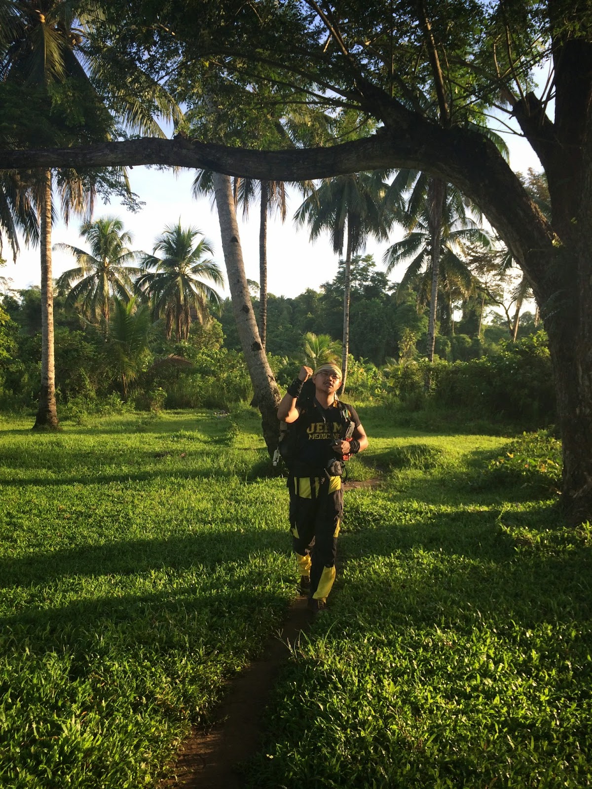
getting ready for the first day challenge

at Kuya Bulldog's house

Resuming the trek at around 10am, we were a bit relieved by the lighter load we had after transferring some of the things to the porter bag. We continued on. The other side of the mountain started to get dark. Kuya Binoy said it’s the area of Tau’t Bato tribe.  And there, it started to rain! It rained that hard that we forgot to rest. It was a nonstop trek and we only managed to have a break when it was lunchtime. We ate wet nuggets for lunch. 

Heavy rains lasted until before 3pm. What a discouraging and dreadful trek! Yet, it was still an advantage that we got no time to rest that it compensated our slow but continuous moving. We also got no problem in hydration as the water was right there in our faces and mouth, LOL! Our rainy trek was full of encounter with the locals (I forgot to ask which among of them are of Tau’t Bato tribe). The terrains are combinations of assault, descending and gradual trails but were muddier and more slippery this time.


Gelo lost his eyeglasses and his sprained knee continues to threaten him. It was such a crazy climb with no enough physical preparation, trainings and all. Yeah, it's really not advisable and all we got was determination and a firm mind to finish the traverse. Despite these limitations, we were able to enjoy the trail and continue to move on. Now the next dilemma was, should we just settle for Kabugan campsite where water source is available, we would be really behind the itinerary by 3 or more hours. 

Kabugan Village
My point here was to make up for the time we lost in the previous day. I had a plane to catch on the 28th and any extended day/s would put me to uncertainty. I insisted to push the trekking until Kawayanan campsite. I checked on Gelo first (of course I would not insist if it’s not possible given his situation) According to him, he could do it. The deal: since water would be the problem in Kawayanan, we cooked the rice ahead which should last until tomorrow’s lunch . We refilled our water bottles and began the night trek. Honestly, night trek is not recommended in Mantalingajan because of the possible encounter of the snakes and that the forest is really messy. There are also cliffs along the trail. I was a bit guilty of it. Gelo could not see the trails clearly and I had to guide his steps when the twilight began. Thankfully, after two hours of believing we would safely reach the next campsite with so much caution in trekking, we finally arrived at Kawayanan. The sky was already calm and there seemed to have no threat of bad weather anymore on that fateful night.
beautiful twilight

DAY 2: A Passionate Move to Reach the Summit


We woke up very early the next day and were able to start the trek as early as 6am. It was the usual messy and mossy forest that we encounter, good thing there were no more rains. It was actually a day of a fine weather. We passed by various points and campsites. We started to come across the cliffs and rocky terrains. 

at Kadiklayan View Deck

assault to Tulanggok Peak

at Tulanggok Peak


For all we know, we were already in Paray-paray campsite by 10:55am.


We set the camp and prepared lunch to fill our stomach in before we do the summit ascent.

At exactly 1PM, we began to ascend guided by Kuya Binoy and Kuya Bulldog was the one left at the campsite. Gelo and I were obviously so excited. What was more amusing was that, we didn’t have to carry our backpacks. Water and a few trail food would be enough. Boulders were like a playground to us that are really pleasurable to trek at.


The entirety of the Mantalingajan which is almost comprised of rocks was now facing us with blue sky on the background indicating and promising that a great weather won’t fail us. The other side of the mountain (Ransang side) was still covered by thick clouds and perhaps just like yesterday, it was raining there. 


It was an open trail of continuous assault with a lot of bonsai trees everywhere. It was risky because piles of huge rocks are what the terrains are almost composed of. Just like in Mt. Guiting-guiting in Romblon, in between the rocks are holes and the rocks itself are pointed and sharp. Still, wearing gloves is necessary.


It doesn’t totally resemble that of summit ascent in Mt. Guiting-guiting (G2)  as the said mountain is a total pile of rocks with almost no plants and soil to walk at. Thus, for me, the ascent to G2 is more technical than the summit ascent to Mantalingajan. 

We also trekked a mossy forest in the middle of this summit ascent.


At 2:45PM, we reached the very summit and it was a 360-degree view although only one side was shown to us (Brooke’s Point side) as the Rizal’s side is still covered by clouds. Filled with joy, we decided to stay longer at the summit. It was fulfilling! We could have seen also the Sabah, Malaysia’s side if it weren't for the clouds that enveloped that side.

stepping up the summit of Mantalingajan for the first time

panoramic 360-degree view of the summit

viewing the Brooke's Point 


selfie with kuya Binoy and Gelo
By 3:55PM (yes, we really enjoyed almost one hour of staying there),  we have started our descent to back to Paray-paray campsite. On our way down, we realized how steep and lengthy the trails are so we were wondering how excited we were in our ascent as we didn't mind such a long assault way up. By 5:25PM, we’re back to Paray-paray. Being sweaty and clammy, we eagerly joined Kuya Binoy going to the water source area. Woooh! It was my first time to take a bath in the mountain. The water  is flowing  that much and it was very cold and soothing. Mixed it up with a great view of sunset because it was an open area.. it really felt wonderful.


as viewed from Paray-paray water source

We went back to the campsite and prepared our food. 


We heard some noise and realize the existence of the mountain rats. They would just appear quickly and are really stubborn.

this cute and "makulit" one was named "Hubert" by Gelo..
i actually don't know his reason behind naming Hubert on all of the creatures that captured our attention, haha

Gelo and I laughed out to death when we heard a disturbing noise inside the tent of Kuya Binoy and Kuya Bulldog. OMG! A mouse was able to enter inside their tent as they chase for our food supplies. They were really funny as they strive to make the rat go out of their tent. Every time I remember such funny scene,  I can’t help but  laugh much about it.. sabi namin parang may naghaharutan sa loob ng tent. LOL!  But the truth is, it was only Kuya Binoy  who was in panic as opposed to Kuya Bulldog  who remained calm. I wonder how they looked like inside the tent. LOL.


DAY 3: An Epic Traverse


This was what I thought of our Day1 and Day2: the trails are no way easy, are dangerous and the trek was really tiring. Yet I have also experienced them in the other tough climbs I did. They weren’t new to me. So I was this proud lady for that specific 2 days. Then this Day3 came, my boastfulness to myself was brought to an end. The traverse is like no other: rocks are so slippery, trails are narrow with only one foot fitted on it and are full of holes, soft and loose soil are dangerous to step at (Twice that I slipped off and thankful that it wasn't a cliff where I fell down), presence of thorny plants, descent are steep and the traverse itself is soooooo lengthy that we did it from 7:30AMto 8:50PM. Do the Math and yes, that's only based on our pacing.. I think, we are the second team of climbers who did the one-day descent (next to Sha’s team in January). The normal itinerary that is being followed is to stay in Lapong or Pirataw campsite. One-day descent is doable but unless you started out early, you’ll surely be doing night trek just like what we have experienced.


I must confess that I unload some of the heavy stuff in my backpack and transferred them to the porter. I know myself for being weak in terms of descending with heavy loads. 

One of the struggles that we endured during this descent was that, we needed to save water. The next water source after Paray-paray is two hours away which is Tabud river and the next stop which we could avail hydration is already in Kupang which is 5 or 6 hours after.

at Tabud river

Kuya Binoy told me before the start of our descent that we need to arrive before 11AM at Lapong campsite, or else we will be staying one more night at Pirataw. Gelo and I tried to beat it although we were about 30-minute late or more as we only managed to start that day at 7:30AM. So I appealed if we could still push through even if we arrived there at 11:30AM.. and the guide agreed. Leaving Tabud river at 9:45AM, I experienced the longest non-stop trekking so far (with only 2-minute water break)... We arrived at Lapong at 11:35AM. It was a zombie trek! Haha.. (walang usap-usap, galit-galit muna).

We stopped at Lapong for lunch. I was a bit nervous at this area owing from the story of Kuya Binoy that it was where the shooting attempt happened when he was guiding a group of climbers sometime in the first quarter of this year. He told me that for a while, after that incident, he was thinking to stop guiding. Now I understand him why during our initial guideship arrangement, he offered us to avail one porter. I think it was really appropriate that we get Kuya Bulldog as our porter, at least Kuya Binoy wasn’t alone especially in this threat of being shot again.

Lapong campsite

on our way down from Lapong campsite

It was truly a long journey passing the Mt. Magringgit and Karim peak. Cliffs and  narrow side trails with only one sole fitted on it never ceased. 


Before nightfall at around 6:38PM, we arrived at a residential area where sari-sari store landmark can be found. We moved on, but this time the trail is much tolerable and night trek is doable. The main difficulty is the steep descent but the trail is already wide and open and is no longer technical. But the fact that our bodies especially our knees are already weakened and tired for the whole day descent, it was apparently a greater effort for us. That point is still more than 500 MASL  I guess, so I was expecting that we still need to endure a longer walking time or worse, a continuous steep descent. 

Gelo was also struggling as it was already dark and again, he couldn't see the trail clearly.

As we move on, I was controlling myself from insanity --- hahaha, I told myself that if this kind of trekking in a dusty, rough road persists in the next two hours, I should start talking to Kuya Bulldog or Gelo. Nakakabaliw ang haba seeing only the light coming from the lamp and anything else is all dark and yet you keep on walking and walking and walking without knowing if we’re already close to the end point. When we spotted a passing bus from afar, it felt like it’s getting normal and we’re close to the civilization hahaha.. We're almost close to National Highway and with much patience to keep on keeping on, we finally arrived at the exit point in Barangay Malis.

Wow, it felt weird walking at a non-rough, concrete road. We were really back to life! :D


And this marks the completion of the much awaited Mantalingajan Traverse which was once a dream. Hurrah, we just made it in three days! Well, I got a big hole in my pockets; I got lots of bruises in my legs, I got muscle pains… but nothing beats the memories created, laughters and joys of the trek, the new experiences encountered, new lessons in camping and the fulfillment of finishing the traverse of this prominent mountain, alive, kicking and strong.

I thank Gelo for joining me in this climb. I wouldn't be able to do this without him especially during camping (hey, I don’t know much about cooking and honestly, this was my first time being not a “senorita” in camping LOL! ). This was my first time to really wake up as early as 3am in the morning and do the cooking tasks.  I experienced being hands on in this climb – deciding for the climb, pitching the tent, and all the practical preparations before, during and after the climb. Now I realized how spoiled brat I am to Buddy Dennis, hahaha. I would like thank him for his all-out support in this Mantalingajan climb.

Other Information:
> Mobile signal (especially Smart) is highly available at Paray-paray campsite and summit but there are also some parts of the trail throughout the traverse where there's a strong signal.
> Presence of limatik in the descent/traverse part

 *Credits to some of the photos captured by Gelo

Read More »
Related Posts Plugin for WordPress, Blogger...