Feb 22-24, 2015
Location: Taichung, Taiwan
Difficulty: 4/5
All that we fought for,
Homes, places we've grown,
All of us are done for.
And we live in a beautiful world,
Yeah we do, yeah we do,
We live in a beautiful world."
 |
| Wuling Farm, Taichung, Taiwan (one of the beautiful photos taken by Qitter) |
Yeah, the melody of this song called "Don't Panic" of Coldplay! I was like feeling emo. :D This has been one of the songs in my playlist as we head back and forth to Taichung City where trailhead of Snow mountain is located. My heart was full of joy. I just wanted to feel every moment of the trip and that excitement when you are closest to reaching a goal. As the lyrics suggest, it was great to feel this good break from work, drive to the countryside, no worries and just live life.
I have always been wanting and craving for more climbs. My feet just couldn't take a rest. And this one is some kind of distinguishable. After testing myself in the altitude of Malaysia's Mt. Kinabalu, the highest in Southeast Asia, I knew I would want to try a winter hike. Taiwan would be a great idea.
For a typical climber like me rooting from a tropical country, you would expect a soul in awe of and excited for a snowy hike.
Three benefits from my opinion:
>I will be witnessing a snow for the first time
>A second (next to Kinabalu) good start to try alpine climbing
>I can land to a new destination, Taiwan, and make some city tour as a sidetrip
ALL ABOUT SNOW MOUNTAIN
(sources: wikipedia, spnp.gov.tw, informative marks along the trail)
 |
Snow mountain or Syue mountain (Xueshan in Chinese) is the second highest mountain in Taiwan, just a bit lower than of Jade mountain (Yushan), the latter being the highest. It has an altitude of 3,886m above sea level (masl).
Xueshan is a part of the Sheipa National Park and so climbers are required to apply for a park entry permit. Wuling farm, I would say, is the jump off point or trailhead of the mountain.
Shei-pa, by the way, is a region of magnificent mountains: within the park are 51 peaks over 3,000 meters high, like Syue Mountain, Dabajian Mountain, Wuling Quadruple Mountains, and Jhihjiayang Mountain. The range of altitudes in the park is from 760 meters above sea level in the Da-an River Valley to 3,886 meters at the top of Syue Mountain.
The name, Shei-Pa, refers to two notable mountains in the park: Syue Mountain and Dabajian Mountain. Syue Mountain is the highest point of the Syue Mountain Range, which stretches northeast-southwest across Taiwan from Sandiaojiao to the Jhuoshuei River. Syue Mountain is one of "Taiwan Quintuple Mountains."
Syue mountain was abbreviated from original Atayal name, "Sekoan." The Atayals (a tribe of Taiwanese aborigines) saw that the southern wall of the mountain was crumbling away, forming vertical gaps, and thus called it "Sekoan" which means "the gaps of the rock wall."
The first recorded ascent was made by a Japanese named, Zaitsu Genkiti who led an expedition to conduct a land survey in July 1915. Academic exploration and research were made from 1926 to 1945.
CLIMB PREPARATION
I made a limited invite to a few good friends of ours in the mountaineering community which ended up with some Kinabalu hiking buddies, Paulo, Beverly and Qitter. And I would say we just built an awesome team. :) Paulo -- the strong one and the "charmer"; Qitter -- the early bird and photographer; Bev who is good in research and directions, and me, the lead and over-all organizer.
 |
| Preclimb Meeting in Dec2014, originally with Ting (Kinabalu hiking buddy) but she had a conflict of schedule |
 |
| Qitter, Me, Bev and Pau at 369 Cabin |
It was in September 2014 when we were able to book for a promo air fare from Cebu Pacific Air. From that time on, I began my research -- from Visa requirements to travel agency to various winter hike gears. I initially intended to make this climb as Do-It-Yourself (DIY) but it wasn't that easy. Well, I don't regret contacting a group to organize for us. The advantages? All we had to do is get a Taiwan Visa, gear up and climb -- no stress in getting a permit and other hassle in getting a transportation and food preparation during the climb. Besides, I was taking a break from work and I deserved a hassle-free trip. Haha!
It was Taiwan Adventures who guided us from preparation to climb proper. Neil Wade, part owner of Taiwan Adventures, was our contact person and climb guide. Yeah, I must say we took out bucks, probably higher than usual, from our pockets. But hey, we've got an English speaking guide and therefore beat the language barrier in Taiwan! He made it easy for us, is reliable and knowledgeable of the entire hike and extended patience for us.
Check out their website at: http://www.taiwan-adventures.com
One of the most important parts of the climb is to get ready for the cold temperature. Taiwan Adventures sent us a guide list:
 |
For queries, you may send to info@Taiwan-Adventures.com
Since it was my first time to do a winter hike, we really don't have some of the required gears. The sleeping bag to be used should be at least zero degree rated one. Since the season is still almost winter and approaching spring, we needed crampons to safely hike on snow. At least one trekking pole is also needed, since I am not used to bringing one, I just rented it. The above were all rented out to us by Taiwan Adventures.
The gears that I had to spare some budget were hiking boots, additional down jacket, rain pants, waterproof socks and gloves.
CLIMB PROPER
It was our second day in Taiwan for the beginning of our hike in Taiwan. Neil picked us up at a nearby Family Mart at 5:30am of February 22nd. Pre-hike discussion and full settlement of fees were done before heading to a 4-hour drive to Taichung.
 |
| Pinkish surroundings! |
Entering the Wuling Farm, we were wowed by the pinkish surroundings which seemed to greet us as we arrive. Yeah, it was the cherry trees blossoming gracefully and making a great delight in our eyes. I realized our climb schedule was a perfect time. Neil said that cherry blossoms usually last for about 1 to 3 weeks only. What a great timing! There were also too many people visiting this place because of Chinese New Year. This was also the reason why we didn't get to start the climb by 21st of February.
 |
| At Ranger Station before start of the trek |
 |
We stopped by for a few minutes to repack our things. We were a bit surprised that we had to carry the sleeping bags and crampons (perhaps I've read it somewhere but forgotten too). What we had in our minds was just like in Mt. Kinabalu where sleeping bags and other equipments are stored in the lodge up in the mountains. We thought we would only be carrying our jackets and other personal stuff. Neil has also asked us to carry some food. I got the rice, meat and oatmeals. Some of our stuff were hand carried.
So I was like not in the condition to carry these stuff. It was pretty hard for me ascending on that day because I am not a heavy loader. I am only used to light backpacking. :D
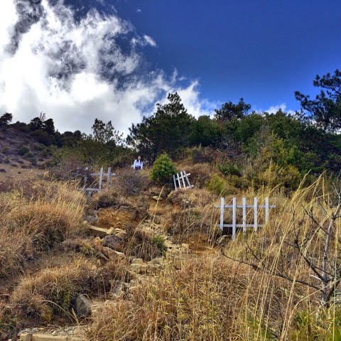
This is the official trailhead where a ranger station is situated.
 |
| No, it's not in Japan, it's the other side of ranger station |
The main peak is 10.9km and that would be the ultimate target. 369 cabin where we would spend two nights is at 7km.
FROM QIKA HUT TO 369 CABIN
The first target was the Qika Hut which is a 2-km trek from the jump-off point. We began ascending by 11am. The elevation here is more or less 2,200m above sea level already. Hence, we only had to walk by more than 1,500masl.
 |
| Photo credit: Neil Wade (neilwade.com) |
The trail is maintained and established but kind of steep. Majority of the portions, actually, has a concrete stairways which are kinda annoying if you don't like ascending on a cemented stairs.
Some parts have logs, which I think, are very useful so that trail can be traced and it won't be too muddy if it's raining.
We arrived at Qika hut past the hour of 12 and ate our lunch there.
 |
| At Qika Hut |
We're the only climbers at that time in Qika. A few minutes after 1pm, we resumed trekking. It was another set of steep ascent. I was asking myself if I can still bear it. There's no problem on the trail as it's really established. The difficulty encountered was like ascending on the hardest mountain to climb in the Philippines. Haha! Yeah I know it was only me... my load... and a little insomnia in the past few days. In the middle of the trek, Qitter offered to carry the rice and meat. It was a good relief! :D
In addition, great things about the trail are that it's a covered forest and not exposed directly to the heat of the sun. Also, though we were perspiring, cold air was everywhere and it was soothing especially when taking some rest.
 |
The steep ascent continued until we reach the point where Crying Slope starts.
 |
 |
| There's the crying slope! |
 |
Vegetation also changed to small bamboo grassland.
 |
Well, you will really go crying if you are not patient enough. One should just keep on trekking up and finally you'll reach the top.
Afterwards, we went through a steady hiking part with now few downhills and uphills. At least this part was no longer a straight steep trail.
And there you go, we reached the East Peak with an altitude of 3,201masl. At the top is a 360-degree view. We saw the mountains capped with snow and of course the 369-cabin.
 |
| The snowy peaks as viewed from East Peak |
 |
| Feeling Nepal! :)) hehe! |
There's actually a trail on the other side if you don't like to scale East Peak.
Going down and heading to the 369 cabin, we passed through the helipad and alternate trails of grassland and forest.
 |
The first two of us arrived at the cabin before 6pm. There were many climbers there already.
The 369 cabin is very basic -- a long house divided into two rooms (left and right) filled with bunk beds, beddings have only rubber mat (so sleeping mat is advisable), no electricity in the bed area except for the kitchen area which is another house. The toilet, while available, is in a not-so-good condition. You just have to bear the bad smell.
 |
| Just like worms as coated by thick sleeping bags at the bunk beds |
Some simple restrictions include not occupying the empty bunk beds and cleaning your muddy shoes before entering --- which impressed me. They practice simple ways of discipline.
 |
| 369 Cabin: Kitchen area |
 |
 |
| Brace yourself to whatever smell awaits you in the toilet! :)) |
It was really cold. We appreciated varieties of food for dinner especially that they were served hot. We changed our clothes, wore our jackets and thermal gears and went to bed as early as 7pm. Yeah, we had a very long time to sleep and rest but it wasn't that fully comfortable. You can never have a continuous sleep due to a very cold temperature, might get worse if attacked by altitude sickness. Just like Paulo and I who had headache. It's tolerable though but indeed not comfy.
FROM 369 CABIN TO THE SUMMIT AND BACK
Wake up call was 6am. We had our breakfast and coffee while looking at this astonishing sunrise.
 |
People at the cabin were already fewer than yesterday.
We prepared our things for summit assault. I wasn't able to use my assault pack of 15L as 2 liters of water, trail food, extra gears like rain gears and crampons are required to bring. Well, I just thought that crampons and other rain gears are already worn from the cabin that's why I thought that bringing a small pack would be a good idea. But it's not enough.
Starting the trek for that day, the first part is similar to the dwarf bamboo grassland of Mt. Pulag in the Philippines and it was all assault.
 |
| No, i'm not in Mt. Pulag, hehe! |
 |
| Photo credi: neilwade.com |
After a few minutes, we reached the entrance to the black forest. It was very nice. The pine trees are very new to me because it's not so similar to the pine forest of Cordillera mountains in my home country.
 |
Funny how we became too fascinated with patches of snow as we progress ourselves in the forest when more and rich ones were actually waiting for us. Neil actually told us that that part is boring.
 |
| Amazed by these patches of snow, haha! |
Below photo entails a rocky terrain in the mountain. According to Neil, this is one of the reasons why hiking boots are used rather than the normal hiking shoes.
 |
 |
As we move closer to the main peak, which is the summit, we encountered more and more snow. The trail runs from steady to steep. It's not technical but then since it's rocky and with a little snow, one should take closely what he is stepping on.
 |
| into the woods |
This was the time that we had to wear crampons.
 |
| first time to wear crampons |
 |
| icy trail ahead :) |
After the forest, we reached the open part and it's almost snow everywhere, although a bit foggy.
It was awesome. Well again, take it from the one experiencing snow for the first time.
 |
| getting foggy and snowy |
Found this sad but cute snowman.
 |
| so I sing, "Do you wanna build a snowman?" |
It was getting foggy as we trek up to the main peak.
It was a tiring but manageable assault to the summit.
 |
| Approaching the summit |
At exactly 12nn, we reached the summit. Since we're all chilling and rain was sort of pouring harder, we just took photos and videos quickly and ate some snacks. We decided to take lunch at the forest instead.
 |
Meanwhile I was amused by the frozen plants around the summit.
 |
| walang kasing saya! :D |
 |
| summit at last! Photo credit: neilwade.com |
Neil told us that if it weren't that foggy, picturesque views there can be seen.
 |
| Here I go! Surreal! |
We had some struggles descending from the main peak. It continued to rain hard and the stable snow trail was kinda vanishing. The raindrops were actually small bits of ice hitting us. Bev almost fell off the cliff. Neil came for assistance.
 |
| Bev, continuing and recovering from the trauma of falling. |
I learned that in order to survive that, you need to secure first the ankle part of the crampons and make sure that it holds the snow. Crampons have twelve spikes, so there's an assurance that it will truly hold the ice. The trekking pole is also a big support while going on the snowy trail.
We stopped by at the forest to have a quick lunch -- ham and cheese wrapped in tortillas. I was chilling so badly.
 |
 |
| yummy but cold! |
We arrived back to the 369 cabin by around 3:30pm.
It was another interrupted night sleep for me due to altitude sickness. Yeah, I knew that aside from the fact that it was actually cold, I rarely drink water.
LAST DAY IN THE MOUNTAIN
We prepared as early as 4:30am.
 |
| beautiful sunrise |
However, our entire descent was rainy. It started to rain when we were about to reach the East Peak.
Our descent lasted for more than 3 hours only. It was easy for us as the trail are almost continuously downward. What I've appreciated a lot is the trekking pole. I'm not used to it. Before, I thought it's just a big hindrance to my trekking but this one, as I had to use it because it's a requirement, it made me realized that it really saves and support my knees. Hehe! I'm more than four years in mountaineering and this was only the first time I realized this.
We arrived back at trailhead by past 9am. After tidying up, we drove back to Taipei.
 |
"Bones, sinking like stones,
All that we fought for,
Homes, places we've grown,
All of us are done for.
And we live in a beautiful world,
Yeah we do, yeah we do,
We live in a beautiful world."
It was that quick! Now, I'm listening again to this song on our way back to Taipei.
 |
| Back in Wuling Farm, still amazingly pinkish! |
Goal accomplished. That's my kind of winter hike. And it's now banked to me as a beautiful memory.
I thank God for the success and completion of this hike, for His protection, for keeping us safe, for the favorable weather, for the strength.
And the thirst for conquering new mountains continues. Looking from afar, I'm giving a thought --- what's the next mountain overseas that I would want to bring to my memories.
*Some photos above were from Qitter, Paulo and Neil Wade

wow.. beautiful...
ReplyDelete